Kampot Province (Kampot)
Kampot Province had a population of 627,884 in 2010 and consist of eight districts divided into 92 communes with a total of 477 villages. Touk Meas City is located in the province.
In the 19th century, during the French Indochina period, Kampot became a regional administrative center with the status of a state border district as a result of the delimitation of the Kingdom of Cambodia. The Circonscription Résidentielle de Kampot contained the arrondissements of Kampot, Kompong-Som, Trang and Kong-Pisey.
In 1889, French colonial census reports a multi-ethnic community: Kampot town consisted of "Cambodian Kampot" on the Prek-Kampot River and "Chinese Kampot" on the right riverbank of the west branch of the Prek-Thom River. Nearby was also a Vietnamese village, called Tien-Thanh and another Vietnamese village on Traeuy Koh Island. A Malay also existed on Traeuy Koh Island. Additional villages of mixed ethnicity are listed.
Map - Kampot Province (Kampot)
Map
Country - Khmer_Republic
 |
 |
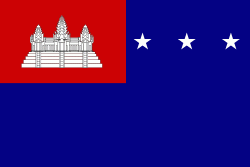
| Flag of Cambodia | |
The main cause of the coup was Norodom Sihanouk's tolerance of North Vietnamese military activity within Cambodia's borders; Vietnamese communist forces had gained de facto control over vast areas of eastern Cambodia as a result. Another important factor was the dire state of the Cambodian economy, an indirect result of Sihanouk's policies of pursuing neutrality.
Currency / Language
| ISO | Currency | Symbol | Significant figures |
|---|---|---|---|
| KHR | Cambodian riel | ៛ | 2 |
| ISO | Language |
|---|---|
| KM | Central Khmer language |
| EN | English language |
| FR | French language |


