Lapland (Lapland)
 |
Lapland's cold and wintry climate, coupled with its relative abundance of conifer trees such as pines and spruces, means that it has become associated with Christmas in some countries, most notably the United Kingdom, and holidays to Lapland are common towards the end of the year. However, the Lapland region has developed its infrastructure for year-round tourism. For example, the 2019 snow-free period tourism grew more than the winter season. Rovaniemi is the main regional center of Lapland, and the Rovaniemi Airport is the third busiest airport in Finland. Besides tourism, other important sectors are trade, manufacturing and construction. Like Rovaniemi, Inari is also one of the most important tourist destinations in Lapland for foreign tourism.
Lapland has been connected with the legendary "North Pole" home of Santa Claus (Father Christmas or Saint Nicholas) since 1927, when Finnish radio host Markus Rautio said that Santa Claus lived on Korvatunturi, a fell (mountain) in the region. Later, Rovaniemi staked a claim as Santa's "official hometown" and developed the Santa Claus Village attraction to encourage tourism.
The area of the Lapland region is 100,367 km², which consists of 92,667 km² of dry land, 6,316 km² fresh water and 1,383 km² of sea water. In the south it borders the Northern Ostrobothnia region, in the west Sweden, in the north and west Norway and in the east Russia. Its borders follow three rivers: Tana, Muonio and Torne. The largest lake is Lake Inari, 1,102 km². Highest point is on Halti, which reaches 1,324 m (4,344 ft) on the Finnish side of the border.
The areas of Enontekiö and Utsjoki in northern Lapland are known as Fell-Lapland. The bulk and remaining Lapland is known as Forest-Lapland. Lake Inari, the many fens of the region and the Salla-Saariselkä mountains are all part of Forest-Lapland. Fell-Lapland lies in the fells of the Scandinavian Mountains. It is not made up of barren ground like blockfields but instead has a vegetation of birch forests, willow thickets or heath. Common soil types in Forest-Lapland are till and sand with conifer forests growing on top. These forests show little variation across Lapland. Compared to southern Finland forest tree species grow slower. Understory is typically made of blueberry, lichens, crowberry and ling.
The landscape of large parts of Lapland is an inselberg plain. It has been suggested the inselberg plains were formed in the Late Cretaceous or Paleogene period by pediplanation or etchplanation. Relative to southern Finland Lapland stands out for its thick till cover. The hills and mountains are typically made up of resistant rocks like granite, gneiss, quartzite and amphibolite. The ice sheet that covered Finland intermittently during the Quaternary grew out from the Scandinavian Mountains. The central parts of the Fennoscandian ice sheet had cold-based conditions during times of maximum extent. This means that in areas like north-east Sweden and northern Finland pre-existing landforms and deposits escaped glacier erosion and are particularly well preserved at present. Northwest to southeast movement of the ice has left a field of aligned drumlins in central Lapland. Ribbed moraines found in the same area reflects a later west to east change in movement of the ice. During the last deglaciation ice in Lapland retreated from the north-east, east and southeast so that the lower course of the Tornio was the last part of Finland to be deglaciated 10,100 years ago. Present-day periglacial conditions in Lapland are reflected in the existence of numerous palsas, permafrost landforms developed on peat.
The bedrock of Lapland belongs to the Karelian Domain occupying the bulk of the region, the Kola Domain in the northeast around Lake Inari and the Scandinavian Caledonides in the tip of Lapland's northwestern arm. With few exceptions rocks are of Archean and Proterozoic age. Granites, gneiss, metasediments and metavolcanics are common rocks while greenstone belts are recurring features. More rare rock associations include mafic and ultramafic layered intrusions and one of the world's oldest ophiolites. The region hosts valuable deposits of gold, chromium, iron and phosphate.
Map - Lapland (Lapland)
Map
Country - Finland
 |
 |
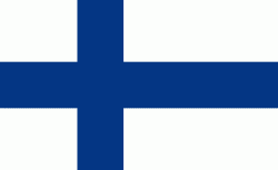
| Flag of Finland | |
Finland was first inhabited around 9000 BC after the Last Glacial Period. The Stone Age introduced several different ceramic styles and cultures. The Bronze Age and Iron Age were characterized by contacts with other cultures in Fennoscandia and the Baltic region. From the late 13th century, Finland became a part of Sweden as a consequence of the Northern Crusades. In 1809, as a result of the Finnish War, Finland became part of the Russian Empire as the autonomous Grand Duchy of Finland, during which Finnish art flourished and the idea of independence began to take hold. In 1906, Finland became the first European state to grant universal suffrage, and the first in the world to give all adult citizens the right to run for public office. After the 1917 Russian Revolution, Finland declared independence from Russia. In 1918, the fledgling state was divided by the Finnish Civil War. During World War II, Finland fought the Soviet Union in the Winter War and the Continuation War, and Nazi Germany in the Lapland War. It subsequently lost parts of its territory, but maintained its independence.
Currency / Language
| ISO | Currency | Symbol | Significant figures |
|---|---|---|---|
| EUR | Euro | € | 2 |
| ISO | Language |
|---|---|
| FI | Finnish language |
| SV | Swedish language |


