Lhuntse District (Lhuentse Dzongkhag)
Lhuntse District (Dzongkha: ལྷུན་རྩེ་རྫོང་ཁག་; Wylie: Lhun-rtse rdzong-khag; previously "Lhuntshi") is one of the 20 dzongkhag (districts) comprising Bhutan. It consists of 2506 households. Located in the northeast, Lhuntse is one of the least developed dzhongkhags of Bhutan. There are few roads, the first gas station was opened in September 2005, electricity is not well distributed, and the difficult terrain makes distribution of social welfare problematic. Despite its favourable climate, farming is hindered by the lack of infrastructure.
Lhuntse is culturally part of eastern Bhutan. The languages and lifestyle of its inhabitants may be contrasted against the dominant western Ngalop culture.
This region is renowned as a textiles producing region and as the ancestral homeland of the Bhutanese royal family.
Lhuntse is culturally part of eastern Bhutan. The languages and lifestyle of its inhabitants may be contrasted against the dominant western Ngalop culture.
This region is renowned as a textiles producing region and as the ancestral homeland of the Bhutanese royal family.
Map - Lhuntse District (Lhuentse Dzongkhag)
Map


Country - Bhutan
 |
 |
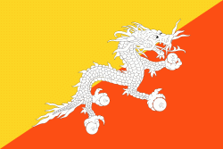
| Flag of Bhutan | |
The subalpine Himalayan mountains in the north rise from the country's lush subtropical plains in the south. In the Bhutanese Himalayas, there are peaks higher than 7000 m above sea level. Gangkhar Puensum is Bhutan's highest peak and is the highest unclimbed mountain in the world. The wildlife of Bhutan is notable for its diversity, including the Himalayan takin and golden langur. The capital and largest city is Thimphu, holding close to 1/7th of the population.
Currency / Language
| ISO | Currency | Symbol | Significant figures |
|---|---|---|---|
| BTN | Bhutanese ngultrum | Nu | 2 |
| INR | Indian rupee | ₹ | 2 |
| ISO | Language |
|---|---|
| DZ | Dzongkha language |