Limpopo
 |
The province is made up of 3 former homelands of Lebowa, Gazankulu and Venda and the former parts of the Transvaal province. The Limpopo province was established as one of the new nine provinces after South Africa's first democratic election on the 27th of April 1994. The province's name was first "Northern Transvaal", later changed to "Northern Province" on the 28th of June 1995, together with two other provinces. The name was later changed again in 2002 to the Limpopo province. Limpopo is made up of 3 main ethnic groups namely; Pedi people, Tsonga and Venda people.
Traditional leaders and chiefs still form a strong backbone of the province's political landscape. Established in terms of the Limpopo House of Traditional Leaders Act, Act 5 of 2005, the Limpopo House of Traditional Leaders' main function is to advise government and the legislature on matters related to custom, tradition and culture including developmental initiatives that have an impact on rural communities. On 18 August 2017 Kgosi Malesela Dikgale was re-elected as the Chairperson of the Limpopo House of Traditional Leaders.
Limpopo Province shares international borders with districts and provinces of three countries: Botswana's Central and Kgatleng districts to the west and northwest respectively, Zimbabwe's Matabeleland South and Masvingo provinces to the north and northeast respectively, and Mozambique's Gaza Province to the east. Limpopo is the link between South Africa and countries further afield in sub-Saharan Africa. On its southern edge, from east to west, it shares borders with the South African provinces of Mpumalanga, Gauteng, and North West. Its border with Gauteng includes that province's Johannesburg-Pretoria axis, the most industrialised metropolis on the continent. The province is at the centre of regional, national, and international developing markets.
Limpopo contains much of the Waterberg Biosphere, a massif of approximately 15000 km2 which is the first region in the northern part of South Africa to be named a UNESCO Biosphere Reserve.
Map - Limpopo
Map


Country - South_Africa
 |
 |
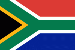
| Flag of South Africa | |
About 80% of the population are Black South Africans. The remaining population consists of Africa's largest communities of European (White South Africans), Asian (Indian South Africans and Chinese South Africans), and multiracial (Coloured South Africans) ancestry. South Africa is a multiethnic society encompassing a wide variety of cultures, languages, and religions. Its pluralistic makeup is reflected in the constitution's recognition of 11 official languages, the fourth-highest number in the world. According to the 2011 census, the two most spoken first languages are Zulu (22.7%) and Xhosa (16.0%). The two next ones are of European origin: Afrikaans (13.5%) developed from Dutch and serves as the first language of most Coloured and White South Africans; English (9.6%) reflects the legacy of British colonialism and is commonly used in public and commercial life.
Currency / Language
| ISO | Currency | Symbol | Significant figures |
|---|---|---|---|
| ZAR | South African rand | Rs | 2 |
| ISO | Language |
|---|---|
| AF | Afrikaans language |
| EN | English language |
| ST | Sotho language |
| SS | Swati language |
| TS | Tsonga language |
| TN | Tswana language |
| VE | Venda language |
| XH | Xhosa language |
| ZU | Zulu language |


