Liège (Province de Liège)
 |
 |
Liège Province is the only Belgian province that has borders with three countries. It borders (clockwise from the north) the Dutch province of Limburg, the German states of North Rhine-Westphalia and Rhineland-Palatinate, Clervaux (canton) in Luxembourg, the Belgian Walloon (French-speaking) provinces of Luxembourg, Namur and Walloon Brabant and the Belgian Flemish (Dutch-speaking) provinces of Flemish Brabant and Limburg.
Part of the eastern-most area of the province, bordering Germany, is the German-speaking region of Eupen-Malmedy, which became part of Belgium in the aftermath of World War I.
The capital and the largest city of the province is the city of the same name, Liège. The province has an area of 3857 km2, and a population of 1,106,992 as of January 2019.
The modern borders of the province of Liège date from 1795, which saw the unification of the Principality of the Prince-Bishopric of Liège with the revolutionary French Department of the Ourthe (sometimes spelled Ourte). (Parts of the old Principality of Liège also went into new French départements Meuse-Inférieure, and Sambre-et-Meuse.)
The province of Ourthe, as it was known then, was under French control during the reign of Napoleon Bonaparte. Napoleon visited the city during one of his campaigns and ordered the destruction of its vineyards in order to prevent the Liège wine industry from competing with its French counterpart.
Following Napoleon's fall from power in 1815, Liège became part of the Kingdom of the Netherlands, while eastern half of modern Verviers became part of the Kingdom of Prussia. Liège University scholars helped to write the new Dutch constitution after the Napoleonic Wars. Despite these contributions there was a widespread perception among the people of Liège that they were discriminated against by the Dutch government due to religious and language differences.
In September 1830, rumors spread that Walloons in Brussels were expelling the Dutch. Liège intellectuals responded to these events by contacting Walloon scholars living in Paris to discuss Belgian independence. A militia was formed to press these demands led by Charlier "Wooden Leg" leading (eventually) to the formation of an independent Kingdom of Belgium.
In the 19th century, the province was an early center of the Industrial Revolution. Its rich coal deposits and steel factories helped Belgium to form the basis of the region's increasing economic power.
During the 20th century, due to Liège's borders with Germany, it saw fierce fighting in both World Wars. In World War I, Liège's strong line of reinforced concrete military forts temporarily halted the German advance through Belgium, giving time to construct trenches in Flanders which subsequently saw some of the worst fighting of that war. It also saw some of the war's worst civilian casualties as the Imperial German Army performed collective punishments against local villagers for acts of resistance. In 1925 the East Cantons and Neutral Moresnet, that had become part of Belgium as a result of the Treaty of Versailles, were absorbed into the province of Liège.
Map - Liège (Province de Liège)
Map
Country - Belgium
 |
 |
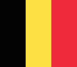
| Flag of Belgium | |
Belgium is a sovereign state and a federal constitutional monarchy with a parliamentary system. Its institutional organization is complex and is structured on both regional and linguistic grounds. It is divided into three highly autonomous regions: the Flemish Region (Flanders) in the north, the Walloon Region (Wallonia) in the south, and the Brussels-Capital Region. Brussels is the smallest and most densely populated region, as well as the richest region in terms of GDP per capita. Belgium is also home to two main linguistic communities: the Flemish Community, which constitutes about 60 percent of the population, and the French Community, which constitutes about 40 percent of the population. A small German-speaking Community, numbering around one percent, exists in the East Cantons. The Brussels-Capital Region is officially bilingual in French and Dutch, although French is the dominant language.
Currency / Language
| ISO | Currency | Symbol | Significant figures |
|---|---|---|---|
| EUR | Euro | € | 2 |
| ISO | Language |
|---|---|
| NL | Dutch language |
| FR | French language |
| DE | German language |


