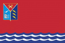
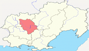
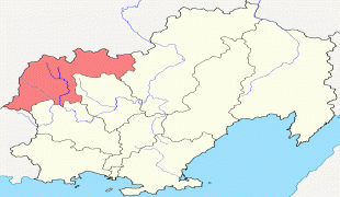
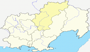
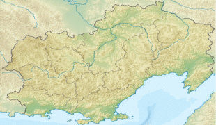
Magadan Oblast (Magadan Oblast)
 |
 |
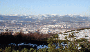
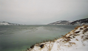
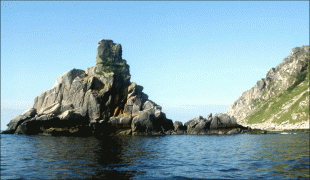
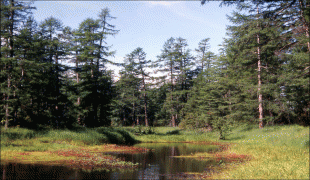
Magadan is the largest city and the capital of Magadan Oblast. The majority of the oblast's inhabitants live in the city itself. The coastline has a less severe climate than the interiors, although both are very cold for its latitude.
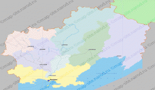
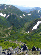
It borders Chukotka Autonomous Okrug in the north, Kamchatka Krai in the east, Khabarovsk Krai in the south and the Sakha Republic in the west. The economy is primarily based on mining, particularly gold, silver and other non-ferrous metals.
Magadan Oblast was established on December 3, 1953 in what had popularly been known as Kolyma. As a result of considerable raw resources, especially gold, silver, tin, and tungsten deposits, mining activities and road building had been developed during the Stalin era in the 1930s and 1940s under the coordination of Dalstroy and its forced labor camps. Upon Stalin's death, Dalstroy was disbanded and the regional administration took over many of its former responsibilities.
From then on, paid labor replaced most of the convict-based manpower, attracted by the region's rapid economic expansion, especially the gold-mining interests.
The indigenous peoples of the region, including the Evens, Koryaks, Yupiks, Chukchis, Orochs, Chuvans and Itelmens, who had traditionally lived from fishing along the Sea of Okhotsk coast or from reindeer herding in the River Kolyma valley, suffered from the industrialization of the area but were able to rely on institutional support until 1987 when Perestroika started to cause many of the older structures to close. As a result, many of those who can no longer rely on traditional sources of income are now unemployed.
Chukotka Autonomous Okrug was formerly administratively subordinated to Magadan Oblast, but declared its separation in 1991.
On 4 July 1997, Magadan, alongside Bryansk, Chelyabinsk, Saratov, and Vologda signed a power-sharing agreement with the government of Russia, granting it autonomy. The agreement would be abolished on 30 January 2002.
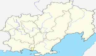
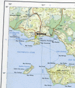
Map - Magadan Oblast (Magadan Oblast)
Map


Country - Russia
 |
 |
| Flag of Russia | |
The East Slavs emerged as a recognisable group in Europe between the 3rd and 8th centuries CE. The first East Slavic state, Kievan Rus', arose in the 9th century, and in 988, it adopted Orthodox Christianity from the Byzantine Empire. Rus' ultimately disintegrated, with the Grand Duchy of Moscow growing to become the Tsardom of Russia. By the early 18th century, Russia had vastly expanded through conquest, annexation, and the efforts of Russian explorers, developing into the Russian Empire, which remains the third-largest empire in history. However, with the Russian Revolution in 1917, Russia's monarchic rule was abolished and replaced by the Russian SFSR—the world's first constitutionally socialist state. Following the Russian Civil War, the Russian SFSR established the Soviet Union (with three other Soviet republics), within which it was the largest and principal constituent. At the expense of millions of lives, the Soviet Union underwent rapid industrialization in the 1930s, and later played a decisive role for the Allies of World War II by leading large-scale efforts on the Eastern Front. With the onset of the Cold War, it competed with the United States for global ideological influence; the Soviet era of the 20th century saw some of the most significant Russian technological achievements, including the first human-made satellite and the first human expedition into outer space.
Currency / Language
| ISO | Currency | Symbol | Significant figures |
|---|---|---|---|
| RUB | Russian ruble | ₽ | 2 |
| ISO | Language |
|---|---|
| CE | Chechen language |
| CV | Chuvash language |
| KV | Komi language |
| RU | Russian language |
| TT | Tatar language |

