Manatí (Manatí Municipio)
 |
 |
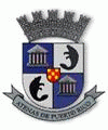
Manatí was founded in 1799 by Don Pedro Menendez Valdes. The Iglesia Nuestra Señora de la Candelaria church was built in the seventeenth century and is still standing in its original spot. Manati is known as La Ciudad Metropolitana (The Metropolitan City), and also as Las Atenas de Puerto Rico, (The Athens of Puerto Rico). It is named after a sea mammal, the manatee (the sea cow).
During those early years, the mayor of the town was Jose Aulet. Juan Ponce de León picked the Manatí leg of the Manuatabón River as the first area to pan for gold. The Aulet family owned lands rich in pineapples, sugar cane, and green bananas. The Aulets sold the land to the government in 1985.
In 1853, the region shifted from mining to an expansion of agriculture, particularly cultivation and processing of sugar cane. The demand for and price of sugar remained high in international markets. The main commodity crop was sugar cane. Carpentry also became popular. During that year, the town consisted of 280 homes, 2 squares, 8 streets and a school with 50 pupils.
Puerto Rico was ceded by Spain in the aftermath of the Spanish–American War under the terms of the Treaty of Paris of 1898 and became a territory of the United States. In 1899, the United States Department of War conducted a census of Puerto Rico finding that the population of Manatí was 13,989.
On September 20, 2017 Hurricane Maria struck Puerto Rico. In Manatí, the hurricane caused major destruction with around 1500 residences destroyed or damaged. Highways were covered in debris and water, leaving communities incommunicado. The breaching of the Río Grande de Manatí caused the destruction of many structures including around 70 residences.
Map - Manatí (Manatí Municipio)
Map
Country - Puerto Rico
 |
 |
Currency / Language
| ISO | Currency | Symbol | Significant figures |
|---|---|---|---|
| USD | United States dollar | $ | 2 |
| ISO | Language |
|---|---|
| EN | English language |
| ES | Spanish language |


