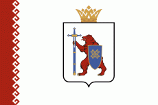
Mari El (Respublika Mariy-El)
 |
 |
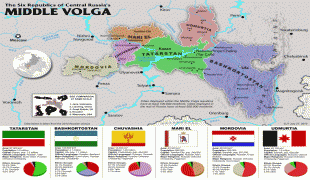
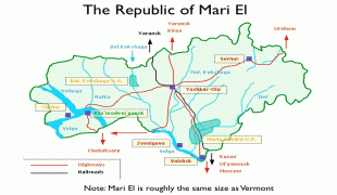
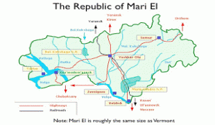
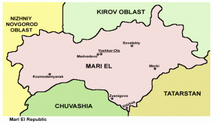
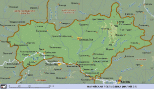
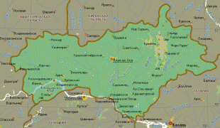
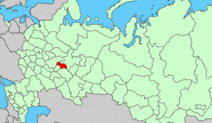
Mari El is one of Russia's ethnic republics, established for the indigenous Mari people, a Finnic nation who have traditionally lived along the Volga River and Kama River. The majority of the Republic's population are ethnic Russians (47.4%) and Mari (43.9%), with minority populations of Tatars and Chuvash. The official languages are Russian and Mari. Mari El is bordered by Nizhny Novgorod Oblast to the west, Kirov Oblast to the north, Tatarstan Republic to the east, and Chuvashia Republic to the south.
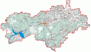
The Republic is located in the eastern part of the East European Plain of Russia, along and mostly to the north of the Volga River. The swampy Mari Depression is in the west of the Republic, contrasted by more hilly landscapes in the east where the highest point of the Republic (at 278 m ) is located. The Republic borders with Kirov Oblast in the north and east, the Republic of Tatarstan in the southeast and south, the Chuvash Republic in the south, and with Nizhny Novgorod Oblast in the west and north.
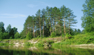
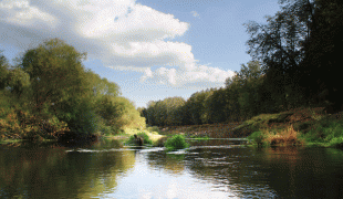
There are 476 rivers in the Republic, with the Volga and its tributaries being the major water arteries. Most rivers are considered to be minor—10 - 50 m wide and 0.5 - 1.4 m deep—and usually freeze between mid-November and mid-April. There are over 700 lakes and ponds; many located in the swampy areas and having areas of less than 1 km2 and depths between 1 and 3 m. Lake Yalchik, occupying 150 ha, is the largest by area, while Lake Tabashinskoye is the deepest. Swamps cover large areas—10 - 70 km2 and up to 100 km2—and usually freeze in December. While swamps tend to be shallow, with an average depth of 0.5 - 1.5 m, they are impassable in fall and spring due to flooding.
Climate is moderately continental, with moderately cold and snowy winters and warm and often rainy summers. The average temperatures range from 18 - 20 C in summer to -18 - -20 C in winter. November is the windiest month of the year. Annual precipitation varies from 450 to 500 mm.
There are virtually no natural resources of industrial significance in the Republic. Other resources include peat, mineral waters, and limestone. About 50% of the Republic's territory is forested, although the level of forestation varies significantly from one district to another.
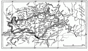
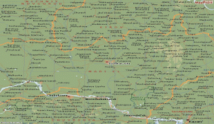
Map - Mari El (Respublika Mariy-El)
Map


Country - Russia
 |
 |
| Flag of Russia | |
The East Slavs emerged as a recognisable group in Europe between the 3rd and 8th centuries CE. The first East Slavic state, Kievan Rus', arose in the 9th century, and in 988, it adopted Orthodox Christianity from the Byzantine Empire. Rus' ultimately disintegrated, with the Grand Duchy of Moscow growing to become the Tsardom of Russia. By the early 18th century, Russia had vastly expanded through conquest, annexation, and the efforts of Russian explorers, developing into the Russian Empire, which remains the third-largest empire in history. However, with the Russian Revolution in 1917, Russia's monarchic rule was abolished and replaced by the Russian SFSR—the world's first constitutionally socialist state. Following the Russian Civil War, the Russian SFSR established the Soviet Union (with three other Soviet republics), within which it was the largest and principal constituent. At the expense of millions of lives, the Soviet Union underwent rapid industrialization in the 1930s, and later played a decisive role for the Allies of World War II by leading large-scale efforts on the Eastern Front. With the onset of the Cold War, it competed with the United States for global ideological influence; the Soviet era of the 20th century saw some of the most significant Russian technological achievements, including the first human-made satellite and the first human expedition into outer space.
Currency / Language
| ISO | Currency | Symbol | Significant figures |
|---|---|---|---|
| RUB | Russian ruble | ₽ | 2 |
| ISO | Language |
|---|---|
| CE | Chechen language |
| CV | Chuvash language |
| KV | Komi language |
| RU | Russian language |
| TT | Tatar language |


