Marlborough Region (Marlborough)
Marlborough District or the Marlborough Region (Te Tauihu-o-te-waka, or Tauihu), commonly known simply as Marlborough, is one of the 16 regions of New Zealand, located on the northeast of the South Island. Marlborough is a unitary authority, both a district and a region. Marlborough District Council is based at Blenheim, the largest town. The unitary region has a population of.
Marlborough is known for its dry climate, the Marlborough Sounds, and Sauvignon blanc wine. It takes its name from the earlier Marlborough Province, which was named after General The 1st Duke of Marlborough, an English general and statesman.
Marlborough's geography can be roughly divided into four sections. The south and west sections are mountainous, particularly the southern section, which rises to the peaks of the Kaikōura Ranges. These two mountainous regions are the final northern vestiges of the ranges that make up the Southern Alps, although that name is rarely applied to mountains this far north.
Between those two sections is the long straight valley of the Wairau River. This broadens to wide plains at its eastern end, in the centre of which stands the town of Blenheim. This region has fertile soil and temperate weather, which has enabled it to become the centre of the New Zealand wine industry.
The fourth geographic zone lies along its north coast. Here the drowned valleys of the Marlborough Sounds make for a convoluted and attractive coastline. The town of Picton is located at the southern end of one of the larger sounds, Queen Charlotte Sound. The town of Havelock is at the southern end of the Pelorus Sound; this sound feeds into Kenepuru Sound.
Map - Marlborough Region (Marlborough)
Map
Country - New_Zealand
 |
 |
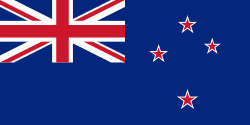
| Flag of New Zealand | |
The islands of New Zealand were the last large habitable land to be settled by humans. Between about 1280 and 1350, Polynesians began to settle in the islands and then developed a distinctive Māori culture. In 1642, the Dutch explorer Abel Tasman became the first European to sight and record New Zealand. In 1840, representatives of the United Kingdom and Māori chiefs signed the Treaty of Waitangi, which in its English version declared British sovereignty over the islands. In 1841, New Zealand became a colony within the British Empire. Subsequently, a series of conflicts between the colonial government and Māori tribes resulted in the alienation and confiscation of large amounts of Māori land. New Zealand became a dominion in 1907; it gained full statutory independence in 1947, retaining the monarch as head of state. Today, the majority of New Zealand's population of 5.1 million is of European descent; the indigenous Māori are the largest minority, followed by Asians and Pacific Islanders. Reflecting this, New Zealand's culture is mainly derived from Māori and early British settlers, with recent broadening of culture arising from increased immigration. The official languages are English, Māori, and New Zealand Sign Language, with the local dialect of English being dominant.
Currency / Language
| ISO | Currency | Symbol | Significant figures |
|---|---|---|---|
| NZD | New Zealand dollar | $ | 2 |
| ISO | Language |
|---|---|
| EN | English language |


