Masunga
Masunga /ˈmɑːsuŋɡʌ/ is a Bakalanga settlement in the North-East District of Botswana. The village is the Headquarters of the North East District. The nearest city is Francistown which is about 120 km away. The Chief of the region is Kgosi Thabo Maruje Masunga III, who took over from his uncle Christopher Masunga.
Near Masunga are the hills of Domboshaba, which hold a ruined outpost of the Kalanga Empire, more like Great Zimbabwe (Mutapa). It is one of the tourist attractions in Botswana where a yearly Ikalanga cultural ceremony takes place.
The language spoken in the North East Region is Kalanga, not Tswana like the rest of Botswana. Kalanga is closely related to Shona, the main language of Zimbabwe.
Things to do in Masunga include:
* 1) Near Masunga are the hills of Domboshaba, which hold a ruined output of the Kalanga Empire
* 2) Rock Art.
* 3) There is a sports complex that caters for different sporting activities.
Map - Masunga
Map
Country - Botswana
 |
|
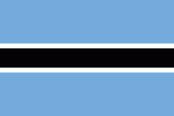
| Flag of Botswana | |
A country of slightly over 2.3 million people, Botswana is one of the most sparsely populated countries in the world. About 11.6 percent of the population lives in the capital and largest city, Gaborone. Formerly one of the world's poorest countries—with a GDP per capita of about US$70 per year in the late 1960s—it has since transformed itself into an upper-middle-income country, with one of the world's fastest-growing economies.
Currency / Language
| ISO | Currency | Symbol | Significant figures |
|---|---|---|---|
| BWP | Botswana pula | P | 2 |
| ISO | Language |
|---|---|
| EN | English language |
| TN | Tswana language |


