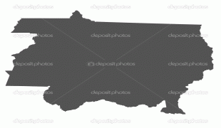
Mato Grosso (Mato Grosso)
 |
 |
Neighboring states (from west clockwise) are: Rondônia, Amazonas, Pará, Tocantins, Goiás and Mato Grosso do Sul. The state is roughly 82.2% of the size of its southwest neighbor, the nation of Bolivia. A state with a flat landscape that alternates between vast chapadas and plain areas, Mato Grosso contains three main ecosystems: the Cerrado, the Pantanal and the Amazon rainforest.
The Chapada dos Guimarães National Park, with caves, grottoes, tracks, and waterfalls, is one of its tourist attractions. The extreme northwest of the state has a small part of the Amazonian forest. The Xingu Indigenous Park and the Araguaia River are in Mato Grosso. Farther south, the Pantanal, the world's largest wetland, is the habitat for nearly one thousand species of animals and many aquatic birds.
The terrain of Mato Grosso is varied and includes cliffs, canyons, and waterfalls. It is home to the Chapada dos Guimarães National Park, a unique environment of sandstone mountains that have eroded into amazingly varied terrain.
The biologically rich Pantanal, one of the world's largest wetland/prairie ecosystems, is also located within this state. Much environmental degradation has occurred to the Pantanal since the late 20th century because of development, and efforts to contain or slow it have had limited success. The Pantanal has a habitat similar to that of the Everglades in Florida in the United States, although the Pantanal is on a much larger scale.
Map - Mato Grosso (Mato Grosso)
Map
Country - Brazil
Currency / Language
| ISO | Currency | Symbol | Significant figures |
|---|---|---|---|
| BRL | Brazilian real | R$ | 2 |
| ISO | Language |
|---|---|
| EN | English language |
| FR | French language |
| PT | Portuguese language |
| ES | Spanish language |


