Map - Minsk Region (Minsk Oblast)

Minsk Region (Minsk Oblast)
Minsk Region or Minsk Oblast or Minsk Voblasts (Мі́нская во́бласць, Minskaja voblasć ; Минская о́бласть, Minskaya oblast) is one of the regions of Belarus. Its administrative center is Minsk, although it is a separate administrative territorial entity of Belarus. As of 2011, the region's population is 1,411,500.

Minsk Region covers a total of 39,900 km², about 19.44% of the national total area. Lake Narach, the largest lake in the country, is located in the northern part of the region. There are four other large lakes in this region: Svir (8th largest), Myadel (11th largest), Syalyava (14th largest) and Myastro (15th largest). It is the only region of Belarus whose border is not part of the international border of Belarus.

 
Map - Minsk Region (Minsk Oblast)
Map
Google Earth - Map - Minsk Region
Google Earth
Openstreetmap - Map - Minsk Region
Openstreetmap
Map - Minsk Region - Esri.WorldImagery
Esri.WorldImagery
Map - Minsk Region - Esri.WorldStreetMap
Esri.WorldStreetMap
Map - Minsk Region - OpenStreetMap.Mapnik
OpenStreetMap.Mapnik
Map - Minsk Region - OpenStreetMap.HOT
OpenStreetMap.HOT
Map - Minsk Region - OpenTopoMap
OpenTopoMap
Map - Minsk Region - CartoDB.Positron
CartoDB.Positron
Map - Minsk Region - CartoDB.Voyager
CartoDB.Voyager
Map - Minsk Region - OpenMapSurfer.Roads
OpenMapSurfer.Roads
Map - Minsk Region - Esri.WorldTopoMap
Esri.WorldTopoMap
Map - Minsk Region - Stamen.TonerLite
Stamen.TonerLite
Country - Belarus
Flag of Belarus
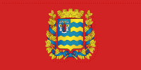
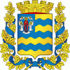
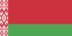
Belarus, officially the Republic of Belarus, is a landlocked country in Eastern Europe. It is bordered by Russia to the east and northeast, Ukraine to the south, Poland to the west, and Lithuania and Latvia to the northwest. Covering an area of 207600 km2 and with a population of 9.2 million, Belarus is the 13th-largest and the 20th-most populous country in Europe. The country has a hemiboreal climate and is administratively divided into seven regions. Minsk is the capital and largest city.

Until the 20th century, different states at various times controlled the lands of modern-day Belarus, including Kievan Rus', the Principality of Polotsk, the Grand Duchy of Lithuania, the Polish–Lithuanian Commonwealth, and the Russian Empire. In the aftermath of the Russian Revolution in 1917, different states arose competing for legitimacy amid the Civil War, ultimately ending in the rise of the Byelorussian SSR, which became a founding constituent republic of the Soviet Union in 1922. After the Polish-Soviet War, Belarus lost almost half of its territory to Poland. Much of the borders of Belarus took their modern shape in 1939, when some lands of the Second Polish Republic were reintegrated into it after the Soviet invasion of Poland, and were finalized after World War II. During World War II, military operations devastated Belarus, which lost about a quarter of its population and half of its economic resources. The republic was redeveloped in the post-war years. In 1945, the Byelorussian SSR became a founding member of the United Nations, along with the Soviet Union.
Currency / Language  
ISO Currency Symbol Significant figures
BYN Belarusian ruble Br 2
Neighbourhood - Country  
  •  Latvia 
  •  Lithuanian Soviet Socialist Republic 
  •  Poland 
  •  Russia 
  •  Ukraine 
Administrative Subdivision
Country, State, Region,...
City, Village,...