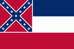
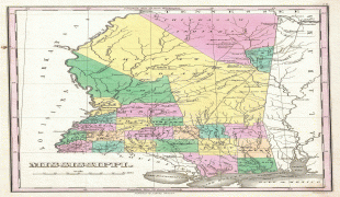
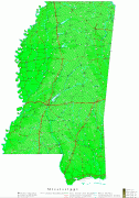
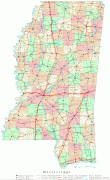
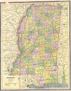
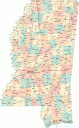
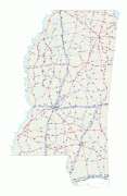
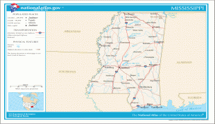
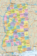
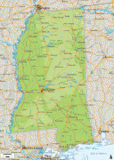
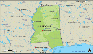
Mississippi
 |
 |
On December 10, 1817, Mississippi became the 20th state admitted to the Union. By 1860, Mississippi was the nation's top cotton-producing state and slaves accounted for 55% of the state population. Mississippi declared its secession from the Union on January 9, 1861, and was one of the seven original Confederate States, which constituted the largest slaveholding states in the nation. Following the Civil War, it was restored to the Union on February 23, 1870.
Until the Great Migration of the 1930s, African Americans were a majority of Mississippi's population. In 2020, 37.6% of Mississippi's population was African American, the highest percentage of any state. Mississippi was the site of many prominent events during the civil rights movement, including the Ole Miss riot of 1962 by white students objecting to desegregation, the 1963 assassination of Medgar Evers, and the 1964 Freedom Summer murders of three activists working on voting rights.
Mississippi frequently ranks low among U.S. states in measures of health, education, and development, while ranking high in measures of poverty. Top economic industries in Mississippi today are agriculture and forestry. Mississippi produces more than half of the country's farm-raised catfish, and is also a top producer of sweet potatoes, cotton and pulpwood. Other main industries in Mississippi include advanced manufacturing, utilities, transportation, and health services.
Mississippi is almost entirely within the Gulf coastal plain, and generally consists of lowland plains and low hills. The northwest remainder of the state consists of the Mississippi Delta, a section of the Mississippi Alluvial Plain. Mississippi's highest point is Woodall Mountain at 807 feet (246 m) above sea level adjacent to the Cumberland Plateau; the lowest is the Gulf of Mexico. Mississippi has a humid subtropical climate classification.
The state's name is derived from the Mississippi River, which flows along and defines its western boundary. European-American settlers named it after the Ojibwe word ᒥᓯ-ᓰᐱ misi-ziibi (great river).
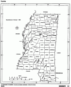
Map - Mississippi
Map


Country - United_States
 |
 |
| Flag of the United States | |
Indigenous peoples have inhabited the Americas for thousands of years. Beginning in 1607, British colonization led to the establishment of the Thirteen Colonies in what is now the Eastern United States. They quarreled with the British Crown over taxation and political representation, leading to the American Revolution and proceeding Revolutionary War. The United States declared independence on July 4, 1776, becoming the first nation-state founded on Enlightenment principles of unalienable natural rights, consent of the governed, and liberal democracy. The country began expanding across North America, spanning the continent by 1848. Sectional division surrounding slavery in the Southern United States led to the secession of the Confederate States of America, which fought the remaining states of the Union during the American Civil War (1861–1865). With the Union's victory and preservation, slavery was abolished nationally by the Thirteenth Amendment.
Currency / Language
| ISO | Currency | Symbol | Significant figures |
|---|---|---|---|
| USD | United States dollar | $ | 2 |
| ISO | Language |
|---|---|
| EN | English language |
| FR | French language |
| ES | Spanish language |


