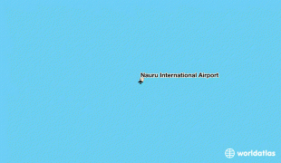
Nauru International Airport (Nauru International Airport)
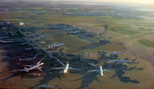
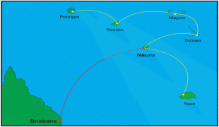
Nauru International Airport is the sole airport in the Republic of Nauru. The airport connects to other island nations, served by Nauru's national airline, Nauru Airlines.
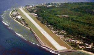
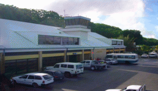
The airstrip was built during the World War II Japanese occupation of Nauru using forced labour. Operations began in January 1943. After the war, it was converted to a civilian airport.
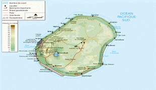
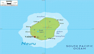
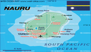
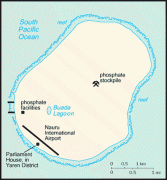
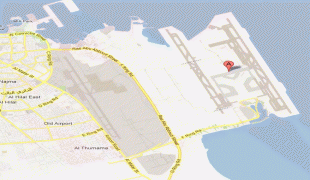
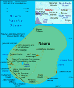
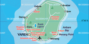
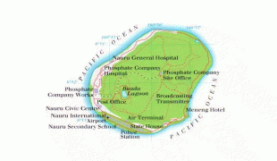
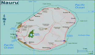
The airport is located in the Yaren district, just north of many of the government buildings, including the Parliament House, police station, and a secondary school. The airport holds the head office of flag carrier, Nauru Airlines.
Also located at the airport are the Republic of Nauru Civil Aviation Authority, tasked with airport security and operational management; the Directorate of Immigration, tasked with control of incoming and outgoing passengers, and the Nauru Customs Service.
The airstrip was built during the World War II Japanese occupation of Nauru using forced labour. Operations began in January 1943. After the war, it was converted to a civilian airport.
The airport is located in the Yaren district, just north of many of the government buildings, including the Parliament House, police station, and a secondary school. The airport holds the head office of flag carrier, Nauru Airlines.
Also located at the airport are the Republic of Nauru Civil Aviation Authority, tasked with airport security and operational management; the Directorate of Immigration, tasked with control of incoming and outgoing passengers, and the Nauru Customs Service.
| IATA Code | INU | ICAO Code | ANYN | FAA Code | |
|---|---|---|---|---|---|
| Telephone | Fax | ||||
| Home page |
Map - Nauru International Airport (Nauru International Airport)
Map


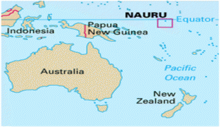
Country - Nauru
 |
 |
| Flag of Nauru | |
Settled by people from Micronesia circa 1000 BCE, Nauru was annexed and claimed as a colony by the German Empire in the late 19th century. After World War I, Nauru became a League of Nations mandate administered by Australia, New Zealand, and the United Kingdom. During World War II, Nauru was occupied by Japanese troops, and was bypassed by the Allied advance across the Pacific. After the war ended, the country entered into United Nations trusteeship. Nauru gained its independence in 1968, and became a member of the Pacific Community (PC) in 1969.
Currency / Language
| ISO | Currency | Symbol | Significant figures |
|---|---|---|---|
| AUD | Australian dollar | $ | 2 |
| ISO | Language |
|---|---|
| EN | English language |
| NA | Nauru language |