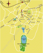
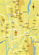
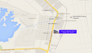
Naypyidaw (Nay Pyi Taw)
Naypyidaw, officially spelled Nay Pyi Taw, is the capital and third-largest city of Myanmar. The city is located at the centre of the Naypyidaw Union Territory. It is unusual among Myanmar's cities, as it is an entirely planned city outside of any state or region. The city, then known only as Pyinmana District, officially replaced Yangon as the administrative capital of Myanmar on 6 November 2005; its official name was revealed to the public on Armed Forces Day, 27 March 2006.
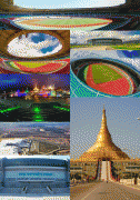
As the seat of the government of Myanmar, Naypyidaw is the site of the Union Parliament, the Supreme Court, the Presidential Palace, the official residences of the Cabinet of Myanmar and the headquarters of government ministries and military. Naypyidaw is notable for its unusual combination of large size and very low population density. The city hosted the 24th and 25th ASEAN Summit, the 3rd BIMSTEC Summit, the Ninth East Asia Summit, the 2013 Southeast Asian Games and the 2014 AFC U-19 Championship.
Naypyidaw is Burmese for "abode of the king", and is generally translated as "royal capital", "seat of the king", or "abode of kings". Traditionally, it was used as a suffix to the names of royal capitals, such as Mandalay, which was called Yattanarbon Naypyidaw (MY ရတနာပုံနေပြည်တော်).
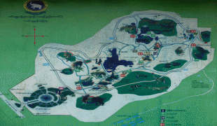
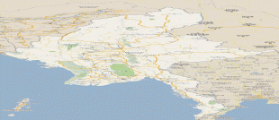
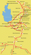
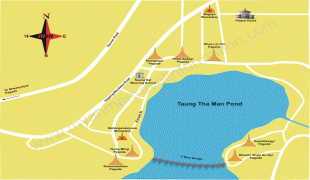
Map - Naypyidaw (Nay Pyi Taw)
Map


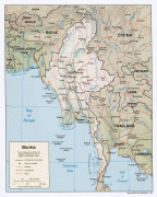
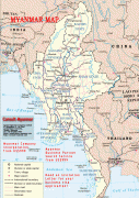

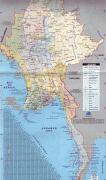
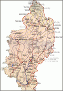
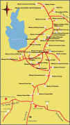
Country - Burma
 |
 |
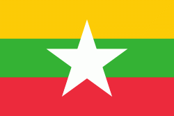
| Flag of Myanmar | |
Early civilisations in the area included the Tibeto-Burman-speaking Pyu city-states in Upper Myanmar and the Mon kingdoms in Lower Myanmar. In the 9th century, the Bamar people entered the upper Irrawaddy valley, and following the establishment of the Pagan Kingdom in the 1050s, the Burmese language, culture, and Theravada Buddhism slowly became dominant in the country. The Pagan Kingdom fell to Mongol invasions, and several warring states emerged. In the 16th century, reunified by the Taungoo dynasty, the country became the largest empire in the history of Southeast Asia for a short period.
Currency / Language
| ISO | Currency | Symbol | Significant figures |
|---|---|---|---|
| MMK | Myanmar kyat | Ks | 2 |
| ISO | Language |
|---|---|
| MY | Burmese language |