New Zealand (New Zealand)
 |
 |
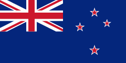
| Flag of New Zealand | |
The islands of New Zealand were the last large habitable land to be settled by humans. Between about 1280 and 1350, Polynesians began to settle in the islands and then developed a distinctive Māori culture. In 1642, the Dutch explorer Abel Tasman became the first European to sight and record New Zealand. In 1840, representatives of the United Kingdom and Māori chiefs signed the Treaty of Waitangi, which in its English version declared British sovereignty over the islands. In 1841, New Zealand became a colony within the British Empire. Subsequently, a series of conflicts between the colonial government and Māori tribes resulted in the alienation and confiscation of large amounts of Māori land. New Zealand became a dominion in 1907; it gained full statutory independence in 1947, retaining the monarch as head of state. Today, the majority of New Zealand's population of 5.1 million is of European descent; the indigenous Māori are the largest minority, followed by Asians and Pacific Islanders. Reflecting this, New Zealand's culture is mainly derived from Māori and early British settlers, with recent broadening of culture arising from increased immigration. The official languages are English, Māori, and New Zealand Sign Language, with the local dialect of English being dominant.
A developed country, New Zealand ranks highly in international comparisons of national performance, such as quality of life, education, protection of civil liberties, government transparency, and economic freedom. The country was the first to introduce a minimum wage, and the first to give women the right to vote. New Zealand underwent major economic changes during the 1980s, which transformed it from a protectionist to a liberalised free-trade economy. The service sector dominates the national economy, followed by the industrial sector, and agriculture; international tourism is also a significant source of revenue. Nationally, legislative authority is vested in an elected, unicameral Parliament, while executive political power is exercised by the Cabinet, led by the prime minister, currently Jacinda Ardern. King Charles III is the country's monarch and is represented by the governor-general. In addition, New Zealand is organised into 11 regional councils and 67 territorial authorities for local government purposes. The Realm of New Zealand also includes Tokelau (a dependent territory); the Cook Islands and Niue (self-governing states in free association with New Zealand); and the Ross Dependency, which is New Zealand's territorial claim in Antarctica.
New Zealand is a member of the United Nations, Commonwealth of Nations, ANZUS, UKUSA, OECD, ASEAN Plus Six, Asia-Pacific Economic Cooperation, the Pacific Community and the Pacific Islands Forum.
The first European visitor to New Zealand, Dutch explorer Abel Tasman, named the islands Staten Land, believing they were part of the Staten Landt that Jacob Le Maire had sighted off the southern end of South America. Hendrik Brouwer proved that the South American land was a small island in 1643, and Dutch cartographers subsequently renamed Tasman's discovery Nova Zeelandia from Latin, after the Dutch province of Zeeland. This name was later anglicised to New Zealand.
This was written as Nu Tireni in the Māori language. In 1834 a document written in Māori and entitled "He Wakaputanga o te Rangatiratanga o Nu Tireni" was translated into English and became the Declaration of the Independence of New Zealand. It was prepared by Te W(h)akaminenga o Nga Rangatiratanga o Nga Hapu o Nu Tireni, the United Tribes of New Zealand, and a copy was sent to King William IV who had already acknowledged the flag of the United Tribes of New Zealand, and who recognised the declaration in a letter from Lord Glenelg.
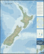
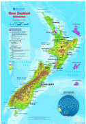
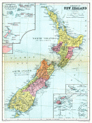
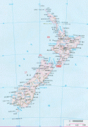
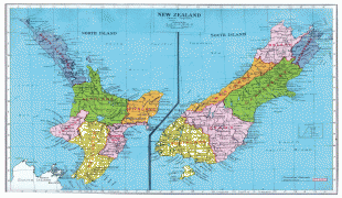
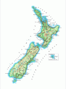
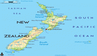
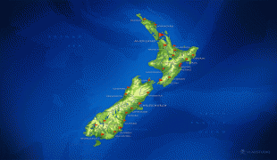
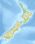
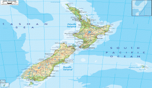
Aotearoa (pronounced in Māori and in English; often translated as 'land of the long white cloud') is the current Māori name for New Zealand. It is unknown whether Māori had a name for the whole country before the arrival of Europeans; Aotearoa originally referred to just the North Island. Māori had several traditional names for the two main islands, including Te Ika-a-Māui ("the fish of Māui") for the North Island and Te Waipounamu ("the waters of greenstone") or Te Waka o Aoraki ("the canoe of Aoraki") for the South Island. Early European maps labelled the islands North (North Island), Middle (South Island), and South (Stewart Island / Rakiura). In 1830, mapmakers began to use "North" and "South" on their maps to distinguish the two largest islands, and by 1907, this was the accepted norm. The New Zealand Geographic Board discovered in 2009 that the names of the North Island and South Island had never been formalised, and names and alternative names were formalised in 2013. This set the names as North Island or Te Ika-a-Māui and South Island or Te Waipounamu. For each island, either its English or Māori name can be used, or both can be used together. Similarly the Māori and English names for the whole country are sometimes used together (Aotearoa New Zealand); however, this has no official recognition.
Currency / Language
| ISO | Currency | Symbol | Significant figures |
|---|---|---|---|
| NZD | New Zealand dollar | $ | 2 |
| ISO | Language |
|---|---|
| EN | English language |