Nonsuch Island (Nonsuch Island)
Nonsuch Island (originally Nonesuch Island) is part of the chain of islands which make up Bermuda. It is in St George's Parish, in the northeast of Bermuda. It is 5.7 ha (14 acres) in area and is at the east entrance to Castle Harbour, close to the south-easternmost point of Cooper's Island (now ostensibly part of the much larger St David's Island). Among the island's charted features is a bay called Nonsuch Bay.
In 1865 it served as a yellow fever quarantine hospital. On the eastern part of the island there still remains a small cemetery. In 1930 it served as a base for William Beebe and Otis Barton's landmark bathysphere dive.
In 1865 it served as a yellow fever quarantine hospital. On the eastern part of the island there still remains a small cemetery. In 1930 it served as a base for William Beebe and Otis Barton's landmark bathysphere dive.
Map - Nonsuch Island (Nonsuch Island)
Map


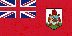
Country - Bermuda
 |
 |
Bermuda is named after Spanish explorer Juan de Bermúdez, who discovered the archipelago in 1505. The islands have been permanently inhabited since 1612, and, forming part of British America, became a crown colony in 1684. The first African slaves arrived in 1616, but as the slave trade ceased by the end of the 17th century, the colony developed into a base for merchants, privateers, and the Royal Navy. More recently, tourism has been a significant contributor to Bermuda's economy. After World War II the territory became an offshore financial centre and tax haven.
Currency / Language
| ISO | Currency | Symbol | Significant figures |
|---|---|---|---|
| BMD | Bermudian dollar | $ | 2 |
| USD | United States dollar | $ | 2 |
| ISO | Language |
|---|---|
| EN | English language |
| PT | Portuguese language |