North Kurdufan (North Kordofan)
 |
North Kordofan is generally arid and desert.
For centuries, North Kordofan was inhabited by nomads and pastoralists, mainly the Dar Hamid, Dar Hamar, Guamaa, Kababish, Bideriya, Shwehat and including the Yazeed tribes. The area has had almost continuous drought since the mid-1960s. Deforestation led to the destruction of the natural vegetation. NGOs working in the villages of Sudan tried to rectify the damage. They set up women's centres. These centres allowed many women gain an income. Training was introduced and a solar energy system set up. NGOs recognise that a need exists for longer projects requiring the kind of support that only can come from governments and large agencies.
The singer Hawa Al-Tagtaga is from the region.
Map - North Kurdufan (North Kordofan)
Map


Country - Sudan
 |
 |
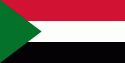
| Flag of Sudan | |
Sudan's history goes back to the Pharaonic period, witnessing the Kingdom of Kerma (c. 2500–1500 BC), the subsequent rule of the Egyptian New Kingdom (c. 1500 BC–1070 BC) and the rise of the Kingdom of Kush (c. 785 BC–350 AD), which would in turn control Egypt itself for nearly a century. After the fall of Kush, the Nubians formed the three Christian kingdoms of Nobatia, Makuria, and Alodia, with the latter two lasting until around 1500. Between the 14th and 15th centuries, most of Sudan was gradually settled by Arab nomads. From the 16th to the 19th centuries, central and eastern Sudan were dominated by the Funj sultanate, while Darfur ruled the west and the Ottomans the east.
Currency / Language
| ISO | Currency | Symbol | Significant figures |
|---|---|---|---|
| SDG | Sudanese pound | جس. | 2 |
| ISO | Language |
|---|---|
| AR | Arabic language |
| EN | English language |