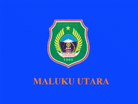
North Maluku (North Maluku)
 |
 |
North Maluku was originally the centre of the four largest Islamic sultanates in the eastern Indonesian archipelago—Bacan, Jailolo, Tidore and Ternate—known as the Moloku Kië Raha (the Four Mountains of Maluku). Upon Europeans' arrival at the beginning of the 16th century, North Maluku became the site of competition between the Portuguese, Spanish and the Dutch to control trade. In the end, the Dutch emerged victorious, beginning three centuries of Dutch rule in the region. The Japanese invaded the region during World War II, and Ternate became the center of the Japanese rule of the Pacific region. Following Indonesian independence, the region became a part of the province of Maluku.
The province of North Maluku was officially established on 12 October 1999, by separation from Maluku. Ternate served as its de facto capital until 2010, when the provincial government moved to Sofifi. The regional economy in North Maluku largely relies on the agricultural sector, fisheries and other types of marine products. The main commodities that support the economic pulse in North Maluku include copra, nutmeg, cloves, fisheries, gold and nickel. North Maluku's agricultural products include rice, corn, roasted sweet potatoes, beans, coconut, potatoes, nutmeg, sago, and eucalyptus.
Historically, the term Maluku referred to the four royal centers in North Maluku, namely Ternate, Tidore, Bacan and Jailolo. A type of confederation consisting of the four kingdoms, which most likely emerged in the 14th century, was called Moloku Kie Raha or "Four Mountains of Maluku". Although the four kingdoms subsequently expanded and covered the entire North Maluku region (as now defined) and parts of Sulawesi and New Guinea, the area of expansion was originally not included in the term Maluku. This only referred to the four main clove-producing islands to the west of Halmahera: Ternate, Tidore. Moti and Makian. Bacan further to the south, and Jailolo on Halmahera, were also commonly included in Maluku Proper, the four kingdoms forming a ritual quadripartition with connotations to local cosmology.
The etymology of the word Maluku is not very clear, and it has been a matter of debate for many experts. The etymology of the word Maluku is not very clear, and it has been a matter of debate for many experts. The first recorded word that can be identified with Maluku comes from Nagarakretagama, an Old Javanese eulogy of 1365. Canto 14 stanza 5 mentioned Maloko, which Pigeaud identified with Ternate or Moluccas. A theory holds that the name Maluku comes from the concept of "Maluku Kie Raha". "Raha" means four, while "kie" here means mountain. referring to 4 mountains of Ternate, Tidore, Bacan, and Jailolo (Halmahera) which have their own kolano (title for local kings). Therefore, the Maluku can come from: "Moloku" here means to grasp or hold. Using these the meaning of "Moloku Kie Raha" is "confederation of four mountain". However the root word "loku" comes from local Malay creole word for a unit, therefore not an indigenous language. The other idea is the word originated from "Maloko" which is a combination of "Ma" which is for support and "Loko" refer to area. The phrase "Maloko Kie Raha" means "the place/world which have four mountains".
Map - North Maluku (North Maluku)
Map
Country - Indonesia
 |
 |
| Flag of Indonesia | |
As the world's third largest democracy, Indonesia is a presidential republic with an elected legislature. It has 38 provinces, of which nine have special status. The country's capital, Jakarta, is the world's second-most populous urban area. Indonesia shares land borders with Papua New Guinea, East Timor, and the eastern part of Malaysia, as well as maritime borders with Singapore, Vietnam, Thailand, the Philippines, Australia, Palau, and India. Despite its large population and densely populated regions, Indonesia has vast areas of wilderness that support one of the world's highest level of biodiversity.
Currency / Language
| ISO | Currency | Symbol | Significant figures |
|---|---|---|---|
| IDR | Indonesian rupiah | Rp | 2 |
| ISO | Language |
|---|---|
| NL | Dutch language |
| EN | English language |
| ID | Indonesian language |
| JV | Javanese language |


