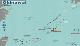
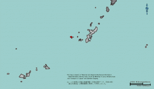
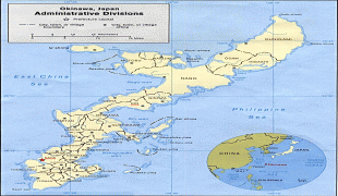
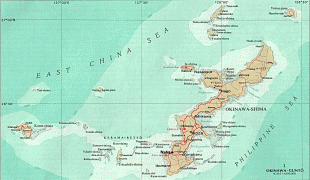
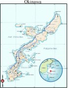
Okinawa Prefecture (Okinawa)
 |
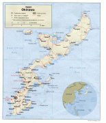
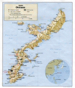
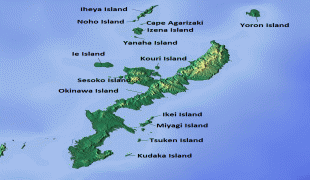
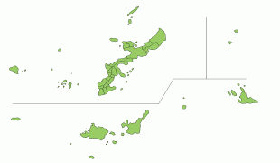
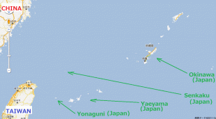
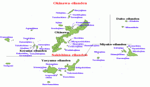
Naha is the capital and largest city of Okinawa Prefecture, with other major cities including Okinawa, Uruma, and Urasoe. Okinawa Prefecture encompasses two thirds of the Ryukyu Islands, including the Okinawa, Daitō and Sakishima groups, extending 1000 km southwest from the Satsunan Islands of Kagoshima Prefecture to Taiwan (Hualien and Yilan Counties). Okinawa Prefecture's largest island, Okinawa Island, is the home to a majority of Okinawa's population. Okinawa Prefecture's indigenous ethnic group are the Ryukyuan people, who also live in the Amami Islands of Kagoshima Prefecture.
Okinawa Prefecture was ruled by the Ryukyu Kingdom from 1429 and unofficially annexed by Japan after the Invasion of Ryukyu in 1609. Okinawa Prefecture was officially founded in 1879 by the Empire of Japan after seven years as the Ryukyu Domain, the last domain of the Han system. Okinawa Prefecture was occupied by the United States of America during the Allied occupation of Japan after World War II, and governed by the Military Government of the Ryukyu Islands from 1945 to 1950 and Civil Administration of the Ryukyu Islands from 1950 until the prefecture was returned to Japan in 1972. Okinawa Prefecture comprises just 0.6 percent of Japan's total land mass but about 26,000 (75%) of United States Forces Japan personnel are assigned to the prefecture; the continued U.S. military presence in Okinawa is controversial.
The oldest evidence of human existence on the Ryukyu islands is from the Stone Age and was discovered in Naha and Yaeyama. Some human bone fragments from the Paleolithic era were unearthed from a site in Naha, but the artifact was lost in transportation before it was examined to be Paleolithic or not. Japanese Jōmon influences are dominant on the Okinawa Islands, although clay vessels on the Sakishima Islands have a commonality with those in Taiwan.
The first mention of the word Ryukyu was written in the Book of Sui. Okinawa was the Japanese word identifying the islands, first seen in the biography of Jianzhen, written in 779. Agricultural societies begun in the 8th century slowly developed until the 12th century. Since the islands are located at the eastern perimeter of the East China Sea relatively close to Japan, China and South-East Asia, the Ryukyu Kingdom became a prosperous trading nation. Also during this period, many Gusukus, similar to castles, were constructed. The Ryukyu Kingdom entered into the Imperial Chinese tributary system under the Ming dynasty beginning in the 15th century, which established economic relations between the two nations.
In 1609, the Shimazu clan, which controlled the region that is now Kagoshima Prefecture, invaded the Ryukyu Kingdom. The Ryukyu Kingdom was obliged to agree to form a suzerain-vassal relationship with the Satsuma and the Tokugawa shogunate, while maintaining its previous role within the Chinese tributary system; Ryukyuan sovereignty was maintained since complete annexation would have created a conflict with China. The Satsuma clan earned considerable profits from trade with China during a period in which foreign trade was heavily restricted by the shogunate.
Although Satsuma maintained strong influence over the islands, the Ryukyu Kingdom maintained a considerable degree of domestic political freedom for over two hundred years. Four years after the 1868 Meiji Restoration, the Japanese government, through military incursions, officially annexed the kingdom and renamed it Ryukyu han. At the time, the Qing Empire asserted a nominal suzerainty over the islands of the Ryukyu Kingdom, since the Ryūkyū Kingdom was also a member state of the Chinese tributary system. Ryukyu han became Okinawa Prefecture of Japan in 1879, even though all other hans had become prefectures of Japan in 1872. In 1912, Okinawans first obtained the right to vote for representatives to the National Diet (国会) which had been established in 1890.
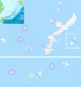
Map - Okinawa Prefecture (Okinawa)
Map


Country - Japan
 |
 |
| Flag of Japan | |
Japan is the eleventh most populous country in the world, as well as one of the most densely populated and urbanized. About three-fourths of the country's terrain is mountainous, concentrating its population of 124.8 million on narrow coastal plains. Japan is divided into 47 administrative prefectures and eight traditional regions. The Greater Tokyo Area is the most populous metropolitan area in the world, with more than 37.2 million residents.
Currency / Language
| ISO | Currency | Symbol | Significant figures |
|---|---|---|---|
| JPY | Japanese yen | ¥ | 0 |
| ISO | Language |
|---|---|
| JA | Japanese language |


