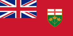
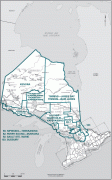
Ontario
 |
 |
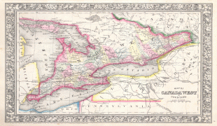
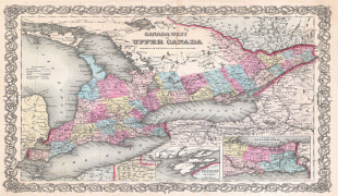
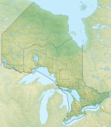
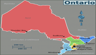
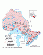
Ontario is bordered by the province of Manitoba to the west, Hudson Bay and James Bay to the north, and Quebec to the east and northeast, and to the south by the U.S. states of (from west to east) Minnesota, Michigan, Ohio, Pennsylvania, and New York. Almost all of Ontario's 2700 km border with the United States follows inland waterways: from the westerly Lake of the Woods, eastward along the major rivers and lakes of the Great Lakes/Saint Lawrence River drainage system. There is only about 1 km of actual land border, made up of portages including Height of Land Portage on the Minnesota border.
The great majority of Ontario's population and arable land is in Southern Ontario. In contrast, Northern Ontario is sparsely populated with cold winters and heavy forestation.
Ontario is a term thought to be derived from Indigenous origins, either Ontarí:io, a Huron (Wyandot) word meaning "great lake", or possibly skanadario, which means "beautiful water" or "sparkling water" in the Iroquoian languages. Ontario has about 250,000 freshwater lakes. The first mention of the name Ontario was in 1641, when "Ontario" was used to describe the land on the north shore of the easternmost part of the Great Lakes. It was adopted as the official name of the new province at Confederation in 1867.
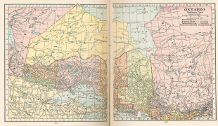
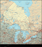
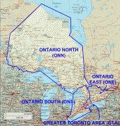
Map - Ontario
Map


Country - Canada
 |
 |
| Flag of Canada | |
Indigenous peoples have continuously inhabited what is now Canada for thousands of years. Beginning in the 16th century, British and French expeditions explored and later settled along the Atlantic coast. As a consequence of various armed conflicts, France ceded nearly all of its colonies in North America in 1763. In 1867, with the union of three British North American colonies through Confederation, Canada was formed as a federal dominion of four provinces. This began an accretion of provinces and territories and a process of increasing autonomy from the United Kingdom. This widening autonomy was highlighted by the Statute of Westminster 1931 and culminated in the Canada Act 1982, which severed the vestiges of legal dependence on the Parliament of the United Kingdom.
Currency / Language
| ISO | Currency | Symbol | Significant figures |
|---|---|---|---|
| CAD | Canadian dollar | $ | 2 |
| ISO | Language |
|---|---|
| EN | English language |
| FR | French language |
| IU | Inuktitut |


