Otjimbingwe
Otjimbingwe (also: Otjimbingue) is a settlement in the Erongo Region of central Namibia. It has approximately 8,000 inhabitants.
The area was already a temporary settlement of some Herero in the early 18th century. Their chief Tjiponda coined the name Otjizingue (refreshing place, referring to the natural spring) from which the settlement's name developed.
The Rhenish Mission Society used Otjimbingwe as a central location for their Namibian mission in 1849. Johannes Rath and his family settled in the area on 11 July that year.
In 1854, copper was found in the nearby Khomas highlands and the Walwich Bay Mining Company established its offices in the city. Miners and merchants flocked to the settlement, and the researcher and businessman Karl Johan Andersson bought the entire settlement in 1860. He sold it five years later to the Rhenish Missionary Society. However the supply had been exhausted by that time, and the mining operations ceded.
The settlement was attacked and plundered several times in its early history. In 1863 the Battle of Otjimbinge took place, one of the largest battles of the Herero-Nama War. Andersson and the Herero fought the Oorlam people under Christian Afrikaner.
Rhenish missionary Carl Hugo Hahn founded the Augustineum, a seminary and teacher training college in 1866. It remained in Otjimbingwe until 1890 and was then moved to Okahandja. Hahn also founded the first school of South West Africa at Otjimbingwe in 1876.
Under the control of Commissioner Dr. Heinrich Ernst Göring, the place became the seat of the colonial administration, the de facto capital, in the late 1880s. On 16 July 1888, German South West Africa first post office opened in town. However, control gradually shifted to Windhoek, and the civil administration moved there in 1892. The railway line from Windhoek and Swakopmund was completed in the early 1900s, bypassing Otjimbingwe, and the city greatly declined in size thereafter.
Map - Otjimbingwe
Map
Country - Namibia
 |
 |
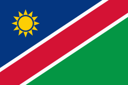
| Flag of Namibia | |
The driest country in sub-Saharan Africa, Namibia has been inhabited since pre-historic times by the San, Damara and Nama people. Around the 14th century, immigrating Bantu peoples arrived as part of the Bantu expansion. Since then, the Bantu groups, the largest being the Ovambo, have dominated the population of the country; since the late 19th century, they have constituted a majority. Today Namibia is one of the least densely populated countries in the world.
Currency / Language
| ISO | Currency | Symbol | Significant figures |
|---|---|---|---|
| NAD | Namibian dollar | $ | 2 |
| ZAR | South African rand | Rs | 2 |
| ISO | Language |
|---|---|
| AF | Afrikaans language |
| EN | English language |
| DE | German language |
| HZ | Herero language |


