Ouaka
Ouaka is one of the 16 prefectures of the Central African Republic. It borders the Democratic Republic of the Congo, covers an area of 49,900 km2, and has a population of 224,076 (2003 census), giving a population density of under 5 inhabitants/km2. The capital is Bambari.
* Adodo
* Afrotcho
* Agbandjo
* Aguéné
* Angbaka
* Angora
* Angoua
* Awatchie
* Azouyomba
* Adodo
* Afrotcho
* Agbandjo
* Aguéné
* Angbaka
* Angora
* Angoua
* Awatchie
* Azouyomba
Map - Ouaka
Map
Country - Central_African_Republic
 |
 |
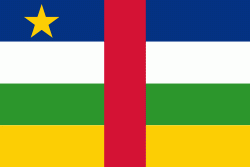
| Flag of the Central African Republic | |
The Central African Republic covers a land area of about 620000 km2. , it had an estimated population of around million. , the Central African Republic is the scene of a civil war, which is ongoing since 2012.
Currency / Language
| ISO | Currency | Symbol | Significant figures |
|---|---|---|---|
| XAF | Central African CFA franc | Fr | 0 |
| ISO | Language |
|---|---|
| FR | French language |
| KG | Kongo language |
| LN | Lingala language |
| SG | Sango language |


