Ratanakiri Province (Ratanakiri)
For over a millennium, Ratanakiri has been occupied by the highland Khmer Loeu people, who are a minority elsewhere in Cambodia. During the region's early history, its Khmer Loeu inhabitants were exploited as slaves by neighboring empires. The slave trade economy ended during the French colonial era, but a harsh Khmerization campaign after Cambodia's independence again threatened Khmer Loeu ways of life. The Khmer Rouge built its headquarters in the province in the 1960s, and bombing during the Vietnam War devastated the region. Today, rapid development in the province is altering traditional ways of life.
Ratanakiri is sparsely populated; its 184,000 residents make up just over 1% of the country's total population. Residents generally live in villages of 20 to 60 families and engage in subsistence shifting agriculture. Ratanakiri is among the least developed provinces of Cambodia. Its infrastructure is poor, and the local government is weak. Health indicators in Ratanakiri are extremely poor; men's life expectancy is 39 years, and women's is 43 years. Education levels are also low, with just under half of the population illiterate.
Ratanakiri has been occupied since at least the Stone or Bronze Age, and trade between the region's highlanders and towns along the Gulf of Thailand dates to at least the 4th century A.D. The region was invaded by Annamites, the Cham, the Khmer, and the Thai during its early history, but no empire ever brought the area under centralized control. From the 13th century or earlier until the 19th century, highland villages were often raided by Khmer, Lao, and Thai slave traders. The region was conquered by local Laotian rulers in the 18th century and then by the Thai in the 19th century. The area was incorporated into French Indochina in 1893, and colonial rule replaced slave trading. The French built huge rubber plantations, especially in Labansiek (present-day Banlung); indigenous workers were used for construction and rubber harvesting. While under French control, the land comprising present-day Ratanakiri was transferred from Siam (Thailand) to Laos and then to Cambodia. Although highland groups initially resisted their colonial rulers, by the end of the colonial era in 1953 they had been subdued.
Ratanakiri Province was created in 1959 from land that had been the eastern area of Stung Treng Province. The name Ratanakiri (រតនគិរី) is formed from the Khmer words រតនៈ (rôtânô "gem" from Sanskrit ratna) and គិរី (kĭri "mountain" from Sanskrit giri), describing two features for which the province is known. During the 1950s and 1960s, Norodom Sihanouk instituted a development and Khmerization campaign in northeast Cambodia that was designed to bring villages under government control, limit the influence of insurgents in the area, and "modernize" indigenous communities. Some Khmer Loeu were forcibly moved to the lowlands to be educated in Khmer language and culture, ethnic Khmer from elsewhere in Cambodia were moved into the province, and roads and large rubber plantations were built. After facing harsh working conditions and sometimes involuntary labor on the plantations, many Khmer Loeu left their traditional homes and moved farther from provincial towns. In 1968, tensions led to an uprising by the Brao people in which several Khmer were killed. The government responded harshly, torching settlements and killing hundreds of villagers.
In the 1960s, the ascendant Khmer Rouge forged an alliance with ethnic minorities in Ratanakiri, exploiting Khmer Loeu resentment of the central government. The Communist Party of Kampuchea headquarters was moved to Ratanakiri in 1966, and hundreds of Khmer Loeu joined CPK units. During this period, there was also extensive Vietnamese activity in Ratanakiri. Vietnamese communists had operated in Ratanakiri since the 1940s; at a June 1969 press conference, Sihanouk said that Ratanakiri was "practically North Vietnamese territory". Between March 1969 and May 1970, the United States undertook a massive covert bombing campaign in the region, aiming to disrupt sanctuaries for communist Vietnamese troops. Villagers were forced outside of main towns to escape the bombings, foraging for food and living on the run with the Khmer Rouge. In June 1970, the central government withdrew its troops from Ratanakiri, abandoning the area to Khmer Rouge control. The Khmer Rouge regime, which had not initially been harsh in Ratanakiri, became increasingly oppressive. The Khmer Loeu were forbidden from speaking their native languages or practicing their traditional customs and religion, which were seen as incompatible with communism. Communal living became compulsory, and the province's few schools were closed. Purges of ethnic minorities increased in frequency, and thousands of refugees fled to Vietnam and Laos. Preliminary studies indicate that bodies accounting for approximately 5% of Ratanakiri's residents were deposited in mass graves, a significantly lower rate than elsewhere in Cambodia.
After the Vietnamese defeated the Khmer Rouge in 1979, government policy toward Ratanakiri became one of benign neglect. The Khmer Loeu were permitted to return to their traditional livelihoods, but the government provided little infrastructure in the province. Under the Vietnamese, there was little contact between the provincial government and many local communities. Long after the fall of the Khmer Rouge regime, however, Khmer Rouge rebels remained in the forests of Ratanakiri. Rebels largely surrendered their arms in the 1990s, though attacks along provincial roads continued until 2002.
Ratanakiri's recent history has been characterized by development and attendant challenges to traditional ways of life. The national government has built roads, encouraged tourism and agriculture, and facilitated rapid immigration of lowland Khmers into Ratanakiri. Road improvements and political stability have increased land prices, and land alienation in Ratanakiri has been a major problem. Despite a 2001 law allowing indigenous communities to obtain collective title to traditional lands, some villages have been left nearly landless. The national government has granted concessions over land traditionally possessed by Ratanakiri's indigenous peoples, and even land "sales" have often involved bribes to officials, coercion, threats, or misinformation. Following the involvement of several international non-governmental organizations (NGOs), land alienation had decreased in frequency as of 2006. In the 2000s, Ratanakiri also received hundreds of Degar (Montagnard) refugees fleeing unrest in neighboring Vietnam; the Cambodian government was criticized for its forcible repatriation of many refugees.
Map - Ratanakiri Province (Ratanakiri)
Map


Country - Khmer_Republic
 |
 |
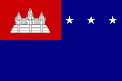
| Flag of Cambodia | |
The main cause of the coup was Norodom Sihanouk's tolerance of North Vietnamese military activity within Cambodia's borders; Vietnamese communist forces had gained de facto control over vast areas of eastern Cambodia as a result. Another important factor was the dire state of the Cambodian economy, an indirect result of Sihanouk's policies of pursuing neutrality.
Currency / Language
| ISO | Currency | Symbol | Significant figures |
|---|---|---|---|
| KHR | Cambodian riel | ៛ | 2 |
| ISO | Language |
|---|---|
| KM | Central Khmer language |
| EN | English language |
| FR | French language |