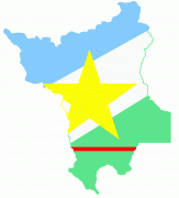
Roraima
 |
 |
The state covers an area of approximately 223644.527 km2, slightly larger than Belarus, being the fourteenth largest Brazilian state by area. The city of Boa Vista is the capital and largest city in the state, and is the only capital in the country located entirely in the Northern Hemisphere. Antônio Denarium, a member of the conservative Progressistas party, has been the governor of the state since 2019.
Roraima is the least populous state in Brazil, with an estimated population of 631,181 inhabitants as of 2020. It is also the state with the lowest population density in Brazil, with 2.01 inhabitants per square kilometre. Its economy, based mainly on the tertiary sector, registers a high growth rate, although its Gross Domestic Product (GDP) is the lowest in the country, with R$ 16.024 billion, representing only 0.20% of the Brazilian economy.
The history of Roraima is strongly linked to the Branco River, which allowed the first Portuguese settlers to arrive in the region. The Branco River Valley's strategic position made it coveted by the English and the Dutch, who entered Brazil through the Guiana Shield in search of indigenous people to be enslaved. The Spaniards also came to invade the northern part of the Branco River and the Uraricoera River through Venezuela. The Portuguese settlers defeated and expelled all invaders, establishing Portugal's sovereignty over the region of Roraima and part of Amazonas.
As a result of crisis in Venezuela since the 2010s, Roraima has become the leading entry point for Venezuelan refugees in Brazil. Displaced Venezuelans in Roraima are estimated to number around 100,000, approximately one-fifth of the state's population.
The word "Roraima" comes from the Pemon language. Its etymology gives it three possible meanings: “Green Peak”, “Mother of the Winds” and “Cashew Mountain”. It would be the junction of roro (parrot) and imã (father, former). In that language, roro- or also rora- means "green", and imã means mountain or peak, thus forming the word "Green Peak", reflecting the natural landscape of that specific region.
There is a possibility that the word "Roraima" has two other meanings: "Mother of the Winds" and "Cashew Mountain". The first meaning comes from the windy climate in the region, where indigenous people believed that the winds that blew southern Venezuela came from that place. The second, "Cashew Mountain", is due to many mountains and hills that exist in the area.
Map - Roraima
Map
Country - Brazil
Currency / Language
| ISO | Currency | Symbol | Significant figures |
|---|---|---|---|
| BRL | Brazilian real | R$ | 2 |
| ISO | Language |
|---|---|
| EN | English language |
| FR | French language |
| PT | Portuguese language |
| ES | Spanish language |


