Map - Saint Barthélemy (Saint Barthelemy)

Saint Barthélemy (Saint Barthelemy)
Saint Barthélemy (Saint-Barthélemy, ), officially the Collectivité territoriale de Saint-Barthélemy, also known as St. Barts (English) or St. Barth (French), is an overseas collectivity of France in the Caribbean. The island lies about 30 km southeast of the island of Saint Martin; it is northeast of the Dutch islands of Saba and Sint Eustatius, as well as north of the independent country of Saint Kitts and Nevis.

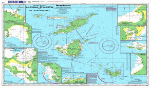
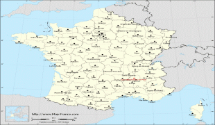
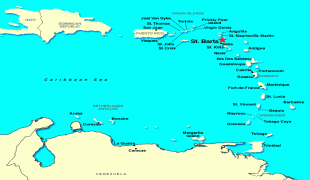
Saint Barthélemy was for many years a French commune forming part of Guadeloupe, which is an overseas region and department of France. In 2003 the island voted in favour of secession from Guadeloupe to form a separate overseas collectivity (collectivité d'outre-mer, abbreviated to COM) of France. The collectivity is one of four territories among the Leeward Islands in the northeastern Caribbean that make up the French West Indies, along with Saint Martin, Guadeloupe (200 km southeast), and Martinique.

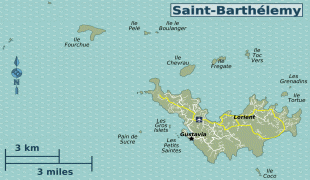
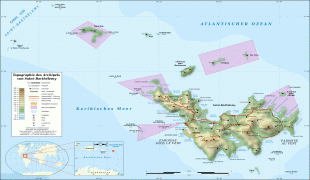
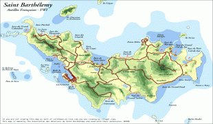
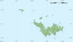
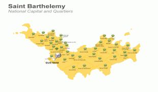
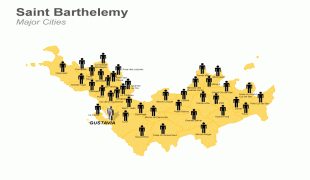
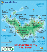
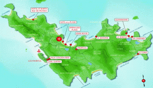
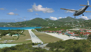
Saint Barthélemy, a volcanic island fully encircled by shallow reefs, has an area of 25 km2 and a population of 9,961 at the Jan. 2017 census. Its capital is Gustavia, which also contains the main harbour. It is the only Caribbean island that was a Swedish colony for any significant length of time (before the end of the Napoleonic Wars, Guadeloupe came under Swedish rule for a year before the Treaty of Paris). It remained so for nearly a century before it returned to French rule after a referendum. Symbolism from the Swedish national arms, the Three Crowns, still appears in the island's coat of arms. The language, cuisine, and culture, however, are distinctly French. The island is a popular tourist destination during the winter holiday season, geared towards the high-end, luxury tourist market.

The island was named by Christopher Columbus for his younger brother Bartholomew Columbus in 1493.

 
Map - Saint Barthélemy (Saint Barthelemy)
Map
Openstreetmap - Map - Saint Barthélemy
Openstreetmap
Anguilla-St-Martin-S...
5301x3783
mappery.com
Anguilla-St-Martin-S...
5301x3783
www.mappery.com
Saint-Barth%C3%A9lem...
3000x2008
upload.wikimedia.org
karte-saint-barthele...
2000x1333
www.worldofmaps.net
sbm06.gif
1446x1064
www.caribbean-on-lin...
administrative-franc...
1000x949
www.map-france.com
administrative-franc...
1000x949
www.map-france.com
france-map-relief-bi...
1000x949
www.map-france.com
administrative-franc...
1000x949
www.map-france.com
administrative-franc...
1000x949
www.map-france.com
Saint-Barth%C3%A9lem...
1175x772
upload.wikimedia.org
saint-barthelemy-qua...
800x600
www.24point0.com
powerpoint-template-...
800x600
www.24point0.com
stbarts.gif
643x705
www.worldatlas.com
222_w.gif
700x577
www.vacationstogo.co...
gMapNorthAmerica_adj...
860x438
www.tradewindaviatio...
st-barts-hotel-map.j...
716x480
www.sbhonline.com
location.gif
750x446
www.freeworldmaps.ne...
Saint_Barthelemy.jpg
640x480
2.bp.blogspot.com
Saint_Barthelemy.jpg
640x480
2.bp.blogspot.com
Airport