Saint David Parish (Saint David)
Saint David is one of Dominica's ten administrative parishes, located on the eastern side of the island. It is bordered by St. Andrew to the north; St. Joseph, St. Paul and St. George to the west; and St. Patrick to the south. It has an area of 131.6 km² (50.8 mi²), and has a population of 6,789.
Its largest settlement is Castle Bruce, with a population of 1,653. It includes the Indigenous community of the *Carib Territory. (Kalinago Territory) which has a population of about 3000 spread across 7 hamlets. Other villages include:
* Grand Fond
* Rosalie
* Good Hope
* Petit Soufrière
* Riviere Cyrique
* Morne Jaune
* San Sauveur
* Carib Territory
Map - Saint David Parish (Saint David)
Map


Country - Dominica
 |
 |
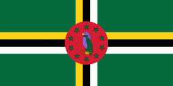
| Flag of Dominica | |
The island was settled by the Arawak arriving from South America in the fifth century. The Kalinago displaced the Arawak by the 15th century. Columbus is said to have passed the island on Sunday, 3 November 1493. It was later colonised by Europeans, predominantly by the French from the 1690s to 1763. The French imported enslaved people from West Africa to Dominica to work on coffee plantations. Great Britain took possession in 1763 after the Seven Years' War, and it gradually established English as its official language. The island gained independence as a republic in 1978.
Currency / Language
| ISO | Currency | Symbol | Significant figures |
|---|---|---|---|
| XCD | East Caribbean dollar | $ | 2 |
| ISO | Language |
|---|---|
| EN | English language |