Saint George Gingerland Parish (Saint George Gingerland)
The parish is commonly referred to as Gingerland, and is named after the valuable ginger crop that used to be grown there. The Anglican parish church of Saint George is located within the main village of Market Shop, and Gingerland also encompasses numerous other villages such as Chicken Stone, Zetlands and Zion. Gingerland is one of the most populous parishes on Nevis, primarily because the higher parts of the parish have fertile soil and good rainfall. The parish is on the windward side of the island (meaning that it faces into the trade winds). Many of the villages in Gingerland are situated at an altitude of nearly 1,000 feet (over 300 meters), making them considerably cooler than coastal villages (especially at night).
Gingerland supplies most of Nevis with fresh fruits and vegetables. The farms are mostly small holdings, where crops are grown for private consumption and for sale. The livestock include sheep and goats, which wander and graze freely; and pigs, cows and horses, which are either fenced or tethered. Feral donkeys roam freely. On the coast around Indian Castle, fishing is important economically.
Tourism is an important industry in Gingerland. The main buildings of hotels such as Old Manor (now closed) and Golden Rock Estate were originally sugarcane plantation "great houses", and some of the other plantation buildings, including the old windmills, have been turned into guest suites or dining areas. A third plantation hotel in the parish is Montpelier Plantation, which is situated not far from the Botanic Garden. The island's racetrack is located in the area near Red Cliff, and the well-attended Nevis horse races take place at approximately monthly intervals.
* Ordnance Survey, Government of the United Kingdom, 1984, Nevis, with part of St. Christopher (Saint Kitts). Series E803 (D.O.S. 343), Sheet Nevis, Edition 5 O.S.D. 1984. Reprinted in 1995, published by the Government of the United Kingdom (Ordnance Survey) for the Government of Saint Christopher (St. Kitts) and Nevis.
* Robinson, Davin & Jennifer Lowery (Editors), 2000. The natural history of the island of Nevis. Nevis Historical and Conservation Society Press, Ithaca, New York.
Map - Saint George Gingerland Parish (Saint George Gingerland)
Map


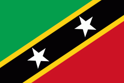
Country - Saint_Kitts_and_Nevis
 |
 |
| Flag of Saint Kitts and Nevis | |
The capital city is Basseterre, located on the larger island of Saint Kitts. Basseterre is also the main port for passenger entry (via cruise ships) and cargo. The smaller island of Nevis lies approximately 3 km to the southeast of Saint Kitts, across a shallow channel called The Narrows.
Currency / Language
| ISO | Currency | Symbol | Significant figures |
|---|---|---|---|
| XCD | East Caribbean dollar | $ | 2 |
| ISO | Language |
|---|---|
| EN | English language |