Seroe Colorado (Sero Colorado)
Seroe Colorado (also: Ceru Colorado and Colorado Point) is a village on the island of Aruba, located at the very southeastern tip of the island. Nowadays it is known for the Anchor in Memory to All Seamen, Between 1878 and 1914, it was the site of the Colorado Guano Mine. The Seroe Colorado Lighthouse is located in Seroe Colorado.
In 1873 or 1874, guano was discovered on Seroe Colorado by Henri Waters Gravenhorst. In 1879, Ch. B. Sewell from London and the Aruba Island Gold Mining Company founded the Aruba Phosphaatmaatschappij to mine the area. The mining started in open quarry mines. Later shaft mines were used. A pier was built in the harbour of San Nicolaas, and a six kilometres narrow-gauge railway line was constructed to connect Seroe Colorado with San Nicolaas.
During World War II, guns were placed on Colorado Point to protect the nearby oil refinery at Lago Colony. In the 21st century, the village and surrounding area have become empty and quiet.
Map - Seroe Colorado (Sero Colorado)
Map


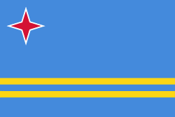
Country - Aruba
 |
 |
Aruba is one of the four countries that form the Kingdom of the Netherlands, along with the Netherlands, Curaçao, and Sint Maarten; the citizens of these countries are all Dutch nationals. Aruba has no administrative subdivisions, but, for census purposes, is divided into eight regions. Its capital is Oranjestad. Unlike much of the Caribbean region, Aruba has a dry climate and an arid, cactus-strewn landscape. The relatively warm and sunny weather, and the climate allow for related tourism activities all year round. Its area is 179 km2 and it is quite densely populated, with 108,166 inhabitants per the 2020 census.
Currency / Language
| ISO | Currency | Symbol | Significant figures |
|---|---|---|---|
| AWG | Aruban florin | Æ’ | 2 |
| ISO | Language |
|---|---|
| NL | Dutch language |
| EN | English language |
| ES | Spanish language |