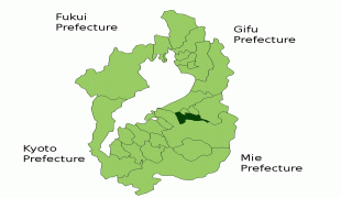
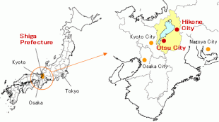
Shiga Prefecture (Shiga)
 |
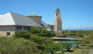
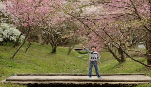
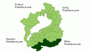
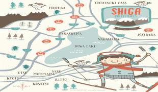
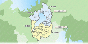
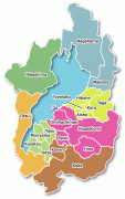
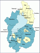
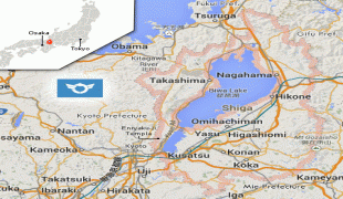
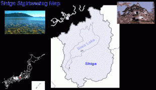
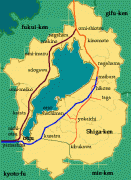
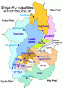
Ōtsu is the capital and largest city of Shiga Prefecture, with other major cities including Kusatsu, Nagahama, and Higashiōmi. Shiga Prefecture encircles Lake Biwa, the largest freshwater lake in Japan, and 37% of the total land area is designated as Natural Parks, the highest of any prefecture. Shiga Prefecture's southern half is located adjacent to the former capital city of Kyoto and forms part of Greater Kyoto, the fourth-largest metropolitan area in Japan. Shiga Prefecture is home to Ōmi beef, the Eight Views of Ōmi, and Hikone Castle, one of four national treasure castles in Japan.
Shiga was known as Ōmi Province or Gōshū before the prefectural system was established. Omi was a neighbor of Nara and Kyoto, at the junction of western and eastern Japan. During the period 667 to 672, Emperor Tenji founded a palace in Otsu. In 742, Emperor Shōmu founded a palace in Shigaraki. In the early Heian period, Saichō was born in the north of Otsu and founded Enryaku-ji, the center of Tendai and one a UNESCO World Heritage Site and monument of Ancient Kyoto now.
During the Heian period, the Sasaki clan ruled Omi, and afterward the Rokkaku clan, Kyōgoku clan and Azai clans ruled Omi. While during the Azuchi-Momoyama period, Oda Nobunaga subjugated Omi and built Azuchi Castle on the eastern shores of Lake Biwa in 1579. Tōdō Takatora, Gamō Ujisato, Oichi, Yodo-dono, Ohatsu and Oeyo were Omi notables during this period.
In 1600, Ishida Mitsunari, born in the east of Nagahama and based in Sawayama Castle, made war against Tokugawa Ieyasu in Sekigahara, Gifu. After the battle, Ieyasu made Ii Naomasa a new lord of Sawayama. Naomasa established the Hikone Domain, later famous for Ii Naosuke. Ii Naosuke became the Tokugawa shogunate's Tairō and concluded commercial treaties with the Western powers and thus ended Japan's isolation from the world in the 19th century. Besides the Hikone Domain, many domains ruled Omi such as Zeze. With the abolition of the han system, eight prefectures were formed in Omi. They were unified into Shiga Prefecture in September 1872. "Shiga Prefecture" was named after "Shiga District" because Otsu belonged to the district until 1898. From August 1876 to February 1881, southern Fukui Prefecture had been incorporated into Shiga Prefecture.
In 2015, Shiga Governor Taizō Mikazuki conducted a survey asking citizens whether they felt it necessary to change the name of the prefecture, partly to raise its profile as a destination for domestic tourism.
Map - Shiga Prefecture (Shiga)
Map


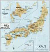

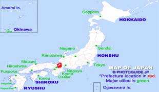
Country - Japan
 |
 |
| Flag of Japan | |
Japan is the eleventh most populous country in the world, as well as one of the most densely populated and urbanized. About three-fourths of the country's terrain is mountainous, concentrating its population of 124.8 million on narrow coastal plains. Japan is divided into 47 administrative prefectures and eight traditional regions. The Greater Tokyo Area is the most populous metropolitan area in the world, with more than 37.2 million residents.
Currency / Language
| ISO | Currency | Symbol | Significant figures |
|---|---|---|---|
| JPY | Japanese yen | ¥ | 0 |
| ISO | Language |
|---|---|
| JA | Japanese language |