Shirak Airport (Shirak Airport)
Gyumri Shirak International Airport (Գյումրի Շիրակ Միջազգային Oդանավակայան), is an international airport serving Gyumri and the province of Shirak, Armenia. It is about 5 km from the center of Gyumri. The airport was inaugurated in 1961, and is the second largest airport in the country, after Yerevan's Zvartnots International Airport.
The airport terminal was built in 1982 by architects Levon Christophorian and Ruben Asratyan. However, after the earthquake in 1988, the airport became largely inoperable and practically unused until it was partially renewed in 2004. At the start of 2006, Armenia felt the importance of having a second airport, when adverse weather conditions meant that many flights had to be diverted from Yerevan's Zvartnots International Airport into Gyumri's Shirak Airport. New radar systems that allow aircraft identification within a 400 km radius were installed in 2006. In 2007, the runway underwent major repairs and was completely re-asphalted. A new Finnish IDMAN light-signal system has been installed since, and repair works have been carried out in the ramp and special ground handling technics have been imported. In 2007 the General Department of Civil Aviation of the Government of Armenia granted Shirak airport an ICAO First Class Airport license. A new arrivals area was inaugurated on September 16, 2021, increasing the airport's capacity to 700,000 passengers per year.
The airport terminal was built in 1982 by architects Levon Christophorian and Ruben Asratyan. However, after the earthquake in 1988, the airport became largely inoperable and practically unused until it was partially renewed in 2004. At the start of 2006, Armenia felt the importance of having a second airport, when adverse weather conditions meant that many flights had to be diverted from Yerevan's Zvartnots International Airport into Gyumri's Shirak Airport. New radar systems that allow aircraft identification within a 400 km radius were installed in 2006. In 2007, the runway underwent major repairs and was completely re-asphalted. A new Finnish IDMAN light-signal system has been installed since, and repair works have been carried out in the ramp and special ground handling technics have been imported. In 2007 the General Department of Civil Aviation of the Government of Armenia granted Shirak airport an ICAO First Class Airport license. A new arrivals area was inaugurated on September 16, 2021, increasing the airport's capacity to 700,000 passengers per year.
| IATA Code | LWN | ICAO Code | UDSG | FAA Code | |
|---|---|---|---|---|---|
| Telephone | Fax | ||||
| Home page |
Map - Shirak Airport (Shirak Airport)
Map
Country - Armenia
 |
 |
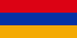
| Flag of Armenia | |
Armenia is a unitary, multi-party, democratic nation-state with an ancient cultural heritage. The first Armenian state of Urartu was established in 860 BC, and by the 6th century BC it was replaced by the Satrapy of Armenia. The Kingdom of Armenia reached its height under Tigranes the Great in the 1st century BC and in the year 301 became the first state in the world to adopt Christianity as its official religion. The ancient Armenian kingdom was split between the Byzantine and Sasanian Empires around the early 5th century. Under the Bagratuni dynasty, the Bagratid Kingdom of Armenia was restored in the 9th century. Declining due to the wars against the Byzantines, the kingdom fell in 1045 and Armenia was soon after invaded by the Seljuk Turks. An Armenian principality and later a kingdom Cilician Armenia was located on the coast of the Mediterranean Sea between the 11th and 14th centuries.
Currency / Language
| ISO | Currency | Symbol | Significant figures |
|---|---|---|---|
| AMD | Armenian dram | Ö | 2 |
| ISO | Language |
|---|---|
| HY | Armenian language |


