Shymkent
Shymkent (Шымкент, Şymkent), known until 1993 as Chimkent (Çımkent, چىمكېنت; Yañalif: Çimkent ), is a city in Kazakhstan. It is near the border with Uzbekistan. It is one of three Kazakh cities which have the status equal to that of a region (“city of republican significance”). It is the third-most populous city in Kazakhstan, behind Almaty and Astana, with an estimated population of 1,002,291. According to regional and city officials, the millionth resident of Shymkent was born on 17 May 2018. It is a regional cultural centre.
Shymkent is situated 690 km west of Almaty and 1,483 km south of Astana. It is also 120 km to the north of Tashkent, Uzbekistan.
The name Chimkent comes from two Sogdian words, chim (meaning 'turf') and kent (or kand) (meaning 'city') (also found in the name of nearby Toshkent); thus, it literally means "the city in the grass/turf."
After Kazakhstan gained independence, the city was renamed Shymkent in 1993 as part of the government's campaign to apply Kazakh names to cities. The formal spelling of Shymkent, as codified in Kazakhstan's Constitution, goes against the original Uzbek spelling rules of never having the letter "ы" follow the letter "ш". (Uzbek itself has no letter ы. Furthermore, what is spelled as ш in Kazakh is spelled as ч in Uzbek.) As a result, the new name Шымкент (Shymkent) is used only in Kazakhstan, while other countries continue to use the original spelling Чимкент (Chimkent).
Map - Shymkent
Map
Country - Kazakhstan
 |
 |
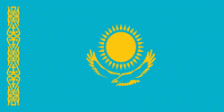
| Flag of Kazakhstan | |
The country dominates Central Asia economically and politically, generating 60 percent of the region's GDP, primarily through its oil and gas industry; it also has vast mineral resources. Officially, it is a democratic, secular, unitary, constitutional republic with a diverse cultural heritage, and has the highest Human Development Index ranking in the region. Kazakhstan is a member state of the United Nations, World Trade Organization, Commonwealth of Independent States, Shanghai Cooperation Organisation, Eurasian Economic Union, Collective Security Treaty Organization, Organization for Security and Cooperation in Europe, Organization of Islamic Cooperation, Organization of Turkic States, and International Organization of Turkic Culture.
Currency / Language
| ISO | Currency | Symbol | Significant figures |
|---|---|---|---|
| KZT | Kazakhstani tenge | ₸ | 2 |
| ISO | Language |
|---|---|
| KK | Kazakh language |
| RU | Russian language |


