Map - Sigave

Sigave
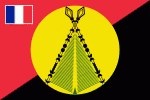
Sigavé (also Singave or Sigave) is one of the three official chiefdoms of the French territory of Wallis and Futuna in Oceania in the South Pacific Ocean. (The other two chiefdoms are Uvea and Alo.)

 
Map - Sigave
Map
Google - Map - Sigave
Google
Google Earth - Map - Sigave
Google Earth
Nokia - Map - Sigave
Nokia
Openstreetmap - Map - Sigave
Openstreetmap
Map - Sigave - Esri.WorldImagery
Esri.WorldImagery
Map - Sigave - Esri.WorldStreetMap
Esri.WorldStreetMap
Map - Sigave - OpenStreetMap.Mapnik
OpenStreetMap.Mapnik
Map - Sigave - OpenStreetMap.HOT
OpenStreetMap.HOT
Map - Sigave - OpenTopoMap
OpenTopoMap
Map - Sigave - CartoDB.Positron
CartoDB.Positron
Map - Sigave - CartoDB.Voyager
CartoDB.Voyager
Map - Sigave - OpenMapSurfer.Roads
OpenMapSurfer.Roads
Map - Sigave - Esri.WorldTopoMap
Esri.WorldTopoMap
Map - Sigave - Stamen.TonerLite
Stamen.TonerLite
Country - Wallis_and_Futuna
Wallis and Futuna, officially the Territory of the Wallis and Futuna Islands, is a French island collectivity in the South Pacific, situated between Tuvalu to the northwest, Fiji to the southwest, Tonga to the southeast, Samoa to the east, and Tokelau to the northeast.

Mata Utu is its capital and largest city. Its land area is 142.42 km2. It had a population of 11,558 at the 2018 census (down from 14,944 at the 2003 census). The territory is made up of three main volcanic tropical islands and a number of tiny islets. It is divided into two island groups that lie about 260 km apart: the Wallis Islands (also known as Uvea) in the northeast; and the Hoorn Islands (also known as the Futuna Islands) in the southwest, including Futuna Island proper and the mostly uninhabited Alofi Island.
Currency / Language  
ISO Currency Symbol Significant figures
XPF CFP franc â‚£ 0
ISO Language
FR French language
Neighbourhood - Country  
Administrative Subdivision
City, Village,...