Sir Seewoosagur Ramgoolam International Airport (Sir Seewoosagur Ramgoolam International Airport)
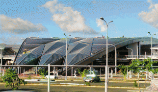
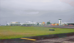
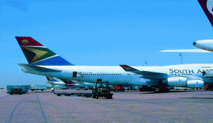
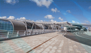
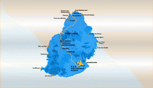
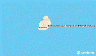
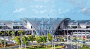
Sir Seewoosagur Ramgoolam International Airport (French: Aéroport International Sir Seewoosagur Ramgoolam) is the primary international airport serving the island nation of Mauritius. It is located at Plaine Magnien, 48 km southeast of the capital city of Port Louis. The airport was previously known as the Plaisance Airport, and has direct flights to several destinations in Africa, Asia and Europe, and is home to the country's national airline, Air Mauritius. Airports of Mauritius Co. Ltd (AML) is the owner and operator of the airport, and the Government of Mauritius is the major shareholder of AML. It is named after Sir Seewoosagur Ramgoolam, the first Prime Minister of Mauritius.
As a part of the defence of Mauritius, in 1942, when Mauritius was a Crown colony, the government started construction of a Royal Naval Air Station at Plaisance near Mahébourg. This was subsequently handed over to the Royal Air Force at the end of World War II and civilian operations started shortly afterwards. The operations of the civil airport started just after the Second World War which gave a boost to the Mauritian economy.
The first flight to Rodrigues island was made on 10 September 1972, an Air Mauritius flight from Plaisance Airport to the Plaine Corail Airport (now Sir Gaëtan Duval Airport) at Rodrigues using a Twin Otter (3B-NAB). Later the Twin Otters were replaced by ATR 42-300 and ATR 42-500 twin turboprops.
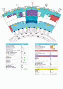
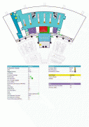
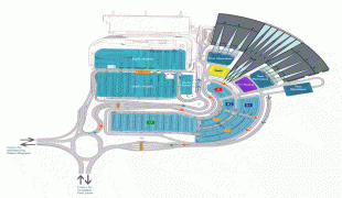
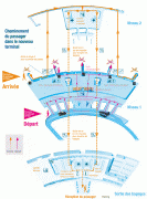
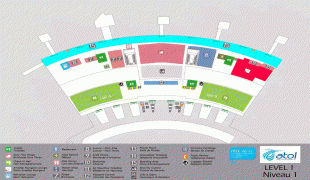
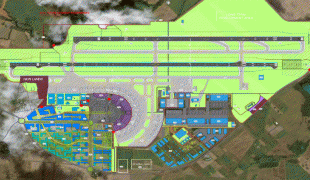
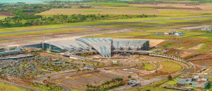
Later in 1986, infrastructure works were undertaken to accommodate larger aircraft. Thus, a new terminal was built including airbridges to meet the expected increase in traffic growth, and a car park attached to the new building and customs service for international routes. The new terminal consisted of two floors and could accommodate up to four aircraft simultaneously via airbridges.
As a part of the defence of Mauritius, in 1942, when Mauritius was a Crown colony, the government started construction of a Royal Naval Air Station at Plaisance near Mahébourg. This was subsequently handed over to the Royal Air Force at the end of World War II and civilian operations started shortly afterwards. The operations of the civil airport started just after the Second World War which gave a boost to the Mauritian economy.
The first flight to Rodrigues island was made on 10 September 1972, an Air Mauritius flight from Plaisance Airport to the Plaine Corail Airport (now Sir Gaëtan Duval Airport) at Rodrigues using a Twin Otter (3B-NAB). Later the Twin Otters were replaced by ATR 42-300 and ATR 42-500 twin turboprops.
Later in 1986, infrastructure works were undertaken to accommodate larger aircraft. Thus, a new terminal was built including airbridges to meet the expected increase in traffic growth, and a car park attached to the new building and customs service for international routes. The new terminal consisted of two floors and could accommodate up to four aircraft simultaneously via airbridges.
| IATA Code | MRU | ICAO Code | FIMP | FAA Code | |
|---|---|---|---|---|---|
| Telephone | 203 603 8000 | Fax | |||
| Home page | Hyperlink |
Map - Sir Seewoosagur Ramgoolam International Airport (Sir Seewoosagur Ramgoolam International Airport)
Map


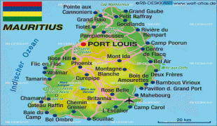
Country - Mauritius
 |
 |
| Flag of Mauritius | |
Arab sailors were the first to discover the uninhabited island, around 975, and they called it Dina Arobi. In 1507, Portuguese sailors visited the uninhabited island. The island appears with the Portuguese names Cirne or Do-Cerne on early Portuguese maps. The Dutch took possession in 1598, establishing a succession of short-lived settlements over a period of about 120 years, before abandoning their efforts in 1710. France took control in 1715, renaming it Isle de France. In 1810, the United Kingdom seized the island, and four years later, in the Treaty of Paris, France ceded Mauritius and its dependencies to the United Kingdom. The British colony of Mauritius included Rodrigues, Agaléga, St. Brandon, the Chagos Archipelago, and, until 1906, the Seychelles. Mauritius and France dispute sovereignty over the island of Tromelin as the Treaty of Paris failed to mention it specifically. Mauritius remained a primarily plantation-based colony of the United Kingdom until independence in 1968.
Currency / Language
| ISO | Currency | Symbol | Significant figures |
|---|---|---|---|
| MUR | Mauritian rupee | ₨ | 2 |
| ISO | Language |
|---|---|
| EN | English language |
| FR | French language |