Smith's Parish (Smith’s Parish)
Smith's Parish is one of the nine parishes of Bermuda. It is named for English aristocrat Sir Thomas Smith/Smythe (1558–1625).
It is located in the northeast of the main island, at the southern end of Harrington Sound, the large lagoon close to the main island's northeastern tip. It is joined to Devonshire Parish in the southwest and Hamilton Parish in the northeast. As with most of Bermuda's parishes, it covers just over 2.3 square miles (about 6.0 km² or 1500 acres). It had a population of 5,984 in 2016.
Natural features in Smith's include Spittal Pond, John Smith's Beach, Devil's Hole, Gibbet Island, and Portuagese Rock.
Map - Smith's Parish (Smith’s Parish)
Map


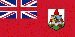
Country - Bermuda
 |
 |
Bermuda is named after Spanish explorer Juan de Bermúdez, who discovered the archipelago in 1505. The islands have been permanently inhabited since 1612, and, forming part of British America, became a crown colony in 1684. The first African slaves arrived in 1616, but as the slave trade ceased by the end of the 17th century, the colony developed into a base for merchants, privateers, and the Royal Navy. More recently, tourism has been a significant contributor to Bermuda's economy. After World War II the territory became an offshore financial centre and tax haven.
Currency / Language
| ISO | Currency | Symbol | Significant figures |
|---|---|---|---|
| BMD | Bermudian dollar | $ | 2 |
| USD | United States dollar | $ | 2 |
| ISO | Language |
|---|---|
| EN | English language |
| PT | Portuguese language |