Map - Southern Highlands Province (Southern Highlands Province)

Southern Highlands Province (Southern Highlands Province)
Southern Highlands is a province in Papua New Guinea. Its provincial capital is the town of Mendi. According to Papua New Guinea's national 2011 census, the total population of Southern Highlands (after the separation of Hela Province) is 515,511 spread across 15,089 km2.

Before the split there were two major ethnic groups, the Huli people and the Angal speakers. Today the majority of the population in Southern Highlands is made up of Angal or Angal Heneng speakers. They occupy the three provinces of Southern Highlands (Nipa, Mendi, Lai Valley, Imbongu (lower Mendi)), Hela (Magarima) and Enga (parts of Kandep).

 
Map - Southern Highlands Province (Southern Highlands Province)
Country - Papua_New_Guinea
Flag of Papua New Guinea
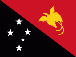
Papua New Guinea (abbreviated PNG;, also ), officially the Independent State of Papua New Guinea (Independen Stet bilong Papua Niugini; Independen Stet bilong Papua Niu Gini), is a country in Oceania that comprises the eastern half of the island of New Guinea and its offshore islands in Melanesia (a region of the southwestern Pacific Ocean north of Australia). Its capital, located along its southeastern coast, is Port Moresby. The country is the world's third largest island country, with an area of 462840 km2.

At the national level, after being ruled by three external powers since 1884, including nearly 60 years of Australian administration starting during World War I, Papua New Guinea established its sovereignty in 1975. It became an independent Commonwealth realm in 1975 with Elizabeth II as its queen. It also became a member of the Commonwealth of Nations in its own right.
Currency / Language  
ISO Currency Symbol Significant figures
PGK Papua New Guinean kina K 2
Neighbourhood - Country  
  •  Indonesia 
Administrative Subdivision
Country, State, Region,...
City, Village,...