Southern Province (Southern Province)
Southern Province comprises the former provinces of Gikongoro, Gitarama, and Butare, and is divided into the districts of Huye, Ruhango, Nyamagabe, Gisagara, Muhanga, Kamonyi, Nyanza, and Nyaruguru.
The capital city of Southern Province is Nyanza.
Map - Southern Province (Southern Province)
Map


Country - Rwanda
 |
 |
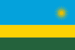
| Flag of Rwanda | |
Hunter-gatherers settled the territory in the Stone and Iron Ages, followed later by Bantu peoples. The population coalesced first into clans, and then, into kingdoms. In the 15th century, one kingdom, under King Gihanga, managed to incorporate several of its close neighbor territories establishing the Kingdom of Rwanda. The Kingdom of Rwanda dominated from the mid-eighteen century, with the Tutsi kings conquering others militarily, centralising power, and enacting anti-Hutu policies. In 1897, Germany colonized Rwanda as part of German East Africa, followed by Belgium, which took control in 1916 during World War I. Both European nations ruled through the Rwandan king and perpetuated a pro-Tutsi policy. The Hutu population revolted in 1959. They massacred numerous Tutsi and ultimately established an independent, Hutu-dominated republic in 1962 led by President Grégoire Kayibanda. A 1973 military coup overthrew Kayibanda and brought Juvénal Habyarimana to power, who retained the pro-Hutu policy. The Tutsi-led Rwandan Patriotic Front (RPF) launched a civil war in 1990. Habyarimana was assassinated in April 1994. Social tensions erupted in the Rwandan genocide that span of one hundred days. The RPF ended the genocide with a military victory in July 1994.
Currency / Language
| ISO | Currency | Symbol | Significant figures |
|---|---|---|---|
| RWF | Rwandan franc | Fr | 0 |
| ISO | Language |
|---|---|
| EN | English language |
| FR | French language |
| RW | Kinyarwanda |
| SW | Swahili language |