Southland Region (Southland)
The earliest inhabitants of Murihiku were Māori of the Waitaha iwi, followed later by Kāti Māmoe and Kāi Tahu, who were then followed by large amounts of Scottish and Irish settlers. By the 1830s, Kāi Tahu had built a thriving industry supplying whaling vessels, looked after whalers and settlers in need, and had begun to integrate with the settlers. The region maintains a strong cultural identity, including its own distinct dialect of English and a very strong Māori and Scottish heritage.
Politically, Murihiku proper extends from Fiordland in the west past the Mataura River to the Catlins the east. Murihiku contains New Zealand's highest waterfall—the Browne Falls, and its deepest lake, Lake Hauroko.Fiordland's terrain is dominated by mountains, fjords and glacial lakes carved up by glaciations during the last ice age, between 75,000 and 15,000 years ago. The region's coast is dotted by several fjords and other sea inlets which stretch from Milford Sound in the north to Preservation Inlet to the south. Farther north and east in Fiordland lie the Darran and Eyre Mountains which are part of the block of schist that extends into neighboring Central Otago. The region is extremely rich in natural resources, with large reserves of forestry, coal, petroleum, and natural gas.
The earliest inhabitants of Murihiku (meaning "the last joint of the tail") were Māori of the Waitaha iwi, followed later by Kāti Māmoe and Kāi Tahu. Waitaha sailed on the Uruao waka, whose captain Rakaihautū named sites and carved out lakes throughout the area. The Takitimu Mountains were formed by the overturned Kāi Tahu waka Tākitimu. Descendants created networks of customary food gathering sites, travelling seasonally as needed, to support permanent and semi-permanent settlements in coastal and inland regions.
In later years, the coastline was a scene of early extended contact between Māori and Europeans, in this case sealers, whalers and missionaries such as Wohlers at Ruapuke Island. Contact was established as early as 1813. By the 1830s, Kāi Tahu had built a thriving industry supplying whaling vessels, looked after whalers and settlers in need, and had begun to integrate with the settlers. Throughout the nineteenth century local Māori continued such regular travel from trade that a "Māori house" had to be built in 1881 to accommodate them when they travelled from Ruapuke and Stewart Island to Bluff to sell produce.
On 10 June 1840, Tūhawaiki, a paramount chief of Kāi Tahu, signed the Treaty of Waitangi aboard HMS Herald (1824) at Ruapuke. Aware that this treaty did not guarantee him sovereignty over his land he had previously asserted that he would sign it if those bringing it to him would sign one he had prepared himself.
In 1853, Walter Mantell purchased Murihiku from local Māori iwi, claiming the land for European settlement. Part of the agreement was that schools and hospitals would be provided alongside each Kāi Tahu village; this promise was not fulfilled. The boundaries of the land sold were also not made sufficiently clear, with Kāi Tahu always maintaining that Fiordland was not intended to be included in this purchase.
Over successive decades, present-day Southland and Otago were settled by large numbers of Scottish settlers. Immigration to New Zealand had been precipitated by an economic depression in Scotland and a schism between the Church of Scotland and the Free Church of Scotland.
In 1852, James Menzies, leader of the Southland separatist movement, became the first Superintendent of the tiny Southland electorate which was still part of the large Otago region. Under the influence of Menzies, Southland Province (a small part of the present Region, centred on Invercargill) seceded from Otago in 1861 following the escalation of political tensions.
However, rising debt forced Southland to rejoin Otago in 1870, and the province was abolished entirely when the Abolition of the Provinces Act came into force on 1 November 1876.
Map - Southland Region (Southland)
Map
Country - New_Zealand
 |
 |
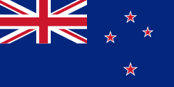
| Flag of New Zealand | |
The islands of New Zealand were the last large habitable land to be settled by humans. Between about 1280 and 1350, Polynesians began to settle in the islands and then developed a distinctive Māori culture. In 1642, the Dutch explorer Abel Tasman became the first European to sight and record New Zealand. In 1840, representatives of the United Kingdom and Māori chiefs signed the Treaty of Waitangi, which in its English version declared British sovereignty over the islands. In 1841, New Zealand became a colony within the British Empire. Subsequently, a series of conflicts between the colonial government and Māori tribes resulted in the alienation and confiscation of large amounts of Māori land. New Zealand became a dominion in 1907; it gained full statutory independence in 1947, retaining the monarch as head of state. Today, the majority of New Zealand's population of 5.1 million is of European descent; the indigenous Māori are the largest minority, followed by Asians and Pacific Islanders. Reflecting this, New Zealand's culture is mainly derived from Māori and early British settlers, with recent broadening of culture arising from increased immigration. The official languages are English, Māori, and New Zealand Sign Language, with the local dialect of English being dominant.
Currency / Language
| ISO | Currency | Symbol | Significant figures |
|---|---|---|---|
| NZD | New Zealand dollar | $ | 2 |
| ISO | Language |
|---|---|
| EN | English language |


