Tanki Flip (Tanki Flip)
Noord is a town and region in Aruba (part of the Kingdom of the Netherlands). This town is known for its low rise and high rise hotels, restaurants, beaches, malls, the California Lighthouse, and other places of attraction.
Places of interest in Noord include Alto Vista Chapel, Bubali Bird Sanctuary, California Lighthouse, Palm Beach and Arashi Beach.
The town of Tanki Flip is home to an Amerindian settlement whose remains date from 1000 to 1500. The village contained several malocas (long houses) with several smaller round houses and a central hut surrounded by an open plaza. The village was fenced off and inhabited by Caquetio people.
Map - Tanki Flip (Tanki Flip)
Map


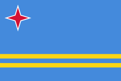
Country - Aruba
 |
 |
Aruba is one of the four countries that form the Kingdom of the Netherlands, along with the Netherlands, Curaçao, and Sint Maarten; the citizens of these countries are all Dutch nationals. Aruba has no administrative subdivisions, but, for census purposes, is divided into eight regions. Its capital is Oranjestad. Unlike much of the Caribbean region, Aruba has a dry climate and an arid, cactus-strewn landscape. The relatively warm and sunny weather, and the climate allow for related tourism activities all year round. Its area is 179 km2 and it is quite densely populated, with 108,166 inhabitants per the 2020 census.
Currency / Language
| ISO | Currency | Symbol | Significant figures |
|---|---|---|---|
| AWG | Aruban florin | Æ’ | 2 |
| ISO | Language |
|---|---|
| NL | Dutch language |
| EN | English language |
| ES | Spanish language |