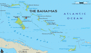
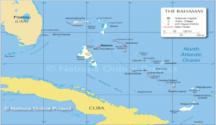
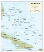
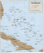
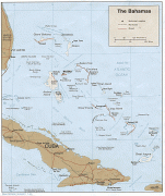
The Bahamas (Commonwealth of The Bahamas)
 |
 |
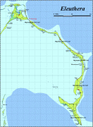
The Bahama Islands were inhabited by the Lucayans, a branch of the Arawakan-speaking Taíno, for many centuries. Christopher Columbus was the first European to see the islands, making his first landfall in the "New World" in 1492 when he landed on the island of San Salvador. Later, the Spanish shipped the native Lucayans to and enslaved them on Hispaniola, after which the Bahama islands were mostly deserted from 1513 until 1648, nearly all native Bahamians having been forcibly removed for enslavement or having died of diseases that Europeans brought to the islands. In 1649, English colonists from Bermuda, known as the Eleutheran Adventurers, settled on the island of Eleuthera.
The Bahamas became a British crown colony in 1718, when the British clamped down on piracy. After the American Revolutionary War, the Crown resettled thousands of American Loyalists to the Bahamas; they took enslaved people with them and established plantations on land grants. Enslaved Africans and their descendants constituted the majority of the population from this period on. The slave trade was abolished by the British in 1807; slavery in the Bahamas was abolished in 1834. Subsequently, The Bahamas became a haven for freed African slaves. Africans liberated from illegal slave ships were resettled on the islands by the Royal Navy, while some North American slaves and Seminoles escaped to The Bahamas from Florida. Bahamians were even known to recognise the freedom of enslaved people carried by the ships of other nations which reached The Bahamas. Today Black-Bahamians make up 90% of the population of 400,516.
The country gained governmental independence in 1973, led by Sir Lynden O. Pindling. Charles III is currently its monarch. In terms of gross domestic product per capita, The Bahamas is one of the richest independent countries in the Americas (following the United States and Canada), with an economy based on tourism and offshore finance.
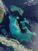
The name Bahamas is derived from the Lucayan name Bahama ('large upper middle island'), used by the indigenous Taíno people for the island of Grand Bahama. Tourist guides often state that the name comes from the Spanish baja mar ('shallow sea'). Wolfgang Ahrens of York University argues that this is a folk etymology. Alternatively, it may originate from Guanahani, a local name of unclear meaning.
First attested on the c. 1523 Turin Map, Bahama originally referred to Grand Bahama alone but was used inclusively in English by 1670. Toponymist Isaac Taylor argues that the name was derived from Bimani (Bimini), which Spaniards in Haiti identified with Palombe, a legendary place where John Mandeville's Travels said there was a fountain of youth.
Currency / Language
| ISO | Currency | Symbol | Significant figures |
|---|---|---|---|
| BSD | Bahamian dollar | $ | 2 |
| ISO | Language |
|---|---|
| EN | English language |