Tindouf
Tindouf (Berber: Tinduf, تندوف) is the main town, and a commune in Tindouf Province, Algeria, close to the Mauritanian, Western Saharan and Moroccan borders. The commune has population of around 160,000 but the census and population estimates do not count the Sahrawi refugees making the population as of the 2008 census 45,966, up from 25,266 in 1998, and an annual population growth rate of 6.3%.
The region is considered of strategic significance. It houses Algerian military bases and an airport with regular flights to Algiers as well as to other domestic destinations. The settlement of Garet Djebilet lies within the municipal territory of Tindouf near the border with Mauritania; the settlement has an iron mine and a defunct airport, and is approximately 70 km northwest of Âouinet Bel Egrâ. Since 1975, it also contains several Sahrawi refugee camps operated by the Polisario Front, a national liberation movement seeking the self-determination of Western Sahara.
The town of Tindouf was built near an isolated Saharan oasis in 1852 by members of the Tajakant tribe, but sacked and destroyed by the Reguibat, another Sahrawi tribe in 1895, and the Tajakant tribe were expelled from the region. It remained deserted until French troops arrived in the area in 1934. Since Algerian independence in 1962, the town has been deliberately built up, partly because of its importance as a last outpost before the Moroccan, Sahrawi and Mauritanian borders.
In 1963, the area was the scene of fighting between Algerian and Moroccan forces laying claim to western Algeria, in the Sand War. The region has since been heavily militarized, increasing its relevance. Since the mid-70s, the Tindouf region served as base for the Polisario Front, a Sahrawi nationalist organization fighting for Western Sahara's independence. The Polisario Front is headquartered in self-administered refugee camps south of the city, which filled up as Moroccan and Mauritanian forces conquered Western Sahara in 1975. During the war years of 1975–1990, Polisario forces struck in Western Sahara, Mauritania (until 1979) and southern Morocco (including the region of Tata), using the Tindouf region as their rear base area with Algerian protection and support. Since 1990 the area has been quiet, although the refugee community remains in Algeria, pending a UN-sponsored peace process and a referendum on independence. (See Minurso.)
Map - Tindouf
Map
Country - Algeria
 |
|
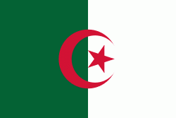
| Flag of Algeria | |
Algeria produced and is linked to many civilizations, empires and dynasties, including ancient Numidians, Phoenicians, Carthaginians, Romans, Vandals, Byzantines, Umayyads, Abbasids, Rustamids, Idrisids, Aghlabids, Fatimids, Zirids, Hammadids, Almoravids, Almohads, Zayyanids, Spaniards, Ottomans and the French colonial empire, with the latter expanded into its present-boundaries. After 132 years of being part of France, tensions between France and the local Algerian populace led to the start of the Algerian War which concluded with Algeria obtaining its independence on 5 July 1962 with the establishment of the People's Democratic Republic on 20 September of that year.
Currency / Language
| ISO | Currency | Symbol | Significant figures |
|---|---|---|---|
| DZD | Algerian dinar | دج | 2 |
| ISO | Language |
|---|---|
| AR | Arabic language |


