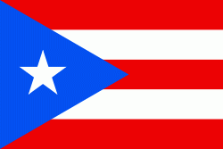
Toa Alta is a tow n and municipality of Puerto Rico located in the northern coast of the island, north of Naranjito; south of Dorado and Toa Baja; east of Vega Alta and Corozal; and west of Bayamón. Toa Alta is spread over eight barrios and Toa Alta Pueblo (the downtown area and the administrative center of the city). It is part of the San Juan-Caguas-Guaynabo metropolitan statistical area. There are nine barrios in Toa Alta and altogether in 2020 had a population of 66,852. Río de la Plata, is a large river that runs through Toa Alta. Toa Alta celebrates its patron saint festival in May.
Toa Alta is located west of the capital city of San Juan and was founded in 1751, making it one of the oldest towns on the main island of Puerto Rico. The construction of the San Fernando Rey Church in the main town square began in 1752. It is popularly said that the name Toa Alta comes from the Taíno word for mother or fertility, Thoa. Most likely the word toa comes from the Taino word for valley or mountain; the region is also known as Valle del Toa (Toa Valley).
Over the years, agriculture became an important economic force in the area. At the peak of the agricultural economy, the town was also known as the "Granja de los Reyes Católicos" (the Farm of the Catholic Monarchs). The town is also called Ciudad del Josco. The town is commonly known by its nickname La Cuna de los Poetas, or "Cradle of Poets", due to the numerous Spanish-language poets born there, such as Abelardo Díaz Alfaro and the musician Tomás "Masso" Rivera.
Hurricane Maria on September 20, 2017 triggered numerous landslides in Toa Alta. Many homes and roads in Toa Alta were destroyed by the hurricane.