Tovuz Rayon (Tovuz Rayon)
Tovuz District (Tovuz rayonu) is one of the 66 districts of Azerbaijan. It is located in the north-west of the country and belongs to the Gazakh-Tovuz Economic Region. The district borders the districts of Gadabay, Shamkir, Samukh, Agstafa, as well as the Tavush Province of Armenia and Kakheti region of Georgia. Its capital and largest city is Tovuz. As of 2020, the district had a population of 177,200. A major train line runs through the center, stopping at Tovuz Station.
In July 2020, Tovuz became the main site for the clashes with Armenia.
Tovuz covers 412 km2. The rayon is mountainous in the south, where it is crossed by the Lesser Caucasus mountains.
The region includes rich deposits of ores and precious metals, notably gold.
The region is located in the north-west of the Republic, bordering Georgia to the north, Armenia to the west, Gadabay to the south and south-west, Shamkir to the east, Samukh from north-east to the north.
The southern part of the district is located in the lowlands, the northern part lies in low mountainous and foothill zone, where positive and negative relief forms are shifted. There are three climate areas in the district:
* Dry subtropical climate. Characterized by soft summers and hot springs.
* Mild hot dry climate. This is a climate up to place less than 1000 meters high. The winter is mild and the spring is warmer.
* Mild cold, forest climate. This climatic hill covers the area from 1,000 to 2,000 meters. The spring is cool, and the winter is a bit frosty.
The river network:
Map - Tovuz Rayon (Tovuz Rayon)
Map
Country - Azerbaijan
 |
 |
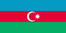
| Flag of Azerbaijan | |
The Azerbaijan Democratic Republic proclaimed its independence from the Transcaucasian Democratic Federative Republic in 1918 and became the first secular democratic Muslim-majority state. In 1920, the country was incorporated into the Soviet Union as the Azerbaijan SSR. The modern Republic of Azerbaijan proclaimed its independence on 30 August 1991, shortly before the dissolution of the Soviet Union in the same year. In September 1991, the ethnic Armenian majority of the Nagorno-Karabakh region formed the self-proclaimed Republic of Artsakh. The region and seven surrounding districts are internationally recognized as part of Azerbaijan pending a solution to the status of the Nagorno-Karabakh through negotiations facilitated by the OSCE, although became de facto independent with the end of the First Nagorno-Karabakh War in 1994. Following the Second Nagorno-Karabakh War in 2020, the seven districts and parts of Nagorno-Karabakh were returned to Azerbaijani control.
Currency / Language
| ISO | Currency | Symbol | Significant figures |
|---|---|---|---|
| AZN | Azerbaijani manat | ₼ | 2 |
| ISO | Language |
|---|---|
| HY | Armenian language |
| AZ | Azerbaijani language |
| RU | Russian language |


