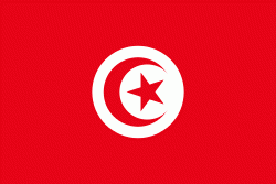
Tunisia, officially the Republic of Tunisia, is the northernmost country in Africa. It is a part of the Maghreb region of North Africa, bordered by Algeria to the west and southwest, Libya to the southeast, and the Mediterranean Sea to the north and east. It features the archaeological sites of Carthage dating back to the 9th century BC, as well as the Great Mosque of Kairouan. Known for its ancient architecture, souks and blue coasts, it covers 163610 km2, and has a population of 12.1 million. It contains the eastern end of the Atlas Mountains and the northern reaches of the Sahara desert; much of its remaining territory is arable land. Its 1300 km of coastline include the African conjunction of the western and eastern parts of the Mediterranean Basin. Tunisia is home to Africa's northernmost point, Cape Angela; and its capital and largest city is Tunis, which is located on its northeastern coast, and lends the country its name.
Beginning in early antiquity, Tunisia was inhabited by the indigenous Berbers. Phoenicians began to arrive in the 12th century BC, establishing several settlements, of which Carthage emerged as the most powerful by the 7th century BC. Carthage was a major mercantile empire and a military rival to the Roman Republic until 146 BC, when it was defeated by the Romans who occupied Tunisia for most of the next 800 years. The Romans introduced Christianity and left architectural legacies like the Amphitheatre of El Jem. In the 7th century AD, Arab Muslims conquered all of Tunisia (finally succeeding in 697 after several attempts starting in 647) and settled with their tribes and families, brought Islam and Arab culture to the local inhabitants, and since then Arabs became the majority of the population. Then, in 1546, the Ottoman Empire established control there, holding sway for over 300 years, until 1881, when the French conquered Tunisia. In 1956, Tunisia gained independence as the Tunisian Republic under the leadership of Habib Bourguiba with the help of activists such as Chedly Kallala, Farhat Hached and Salah Ben Youssef. Today, Tunisia's culture and identity are rooted in this centuries-long intersection of different cultures and ethnicities.


