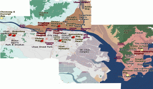
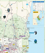
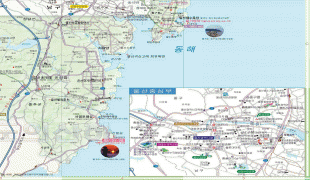
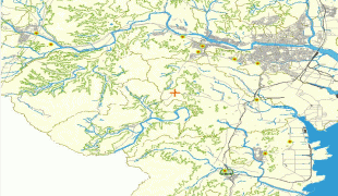
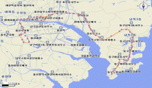
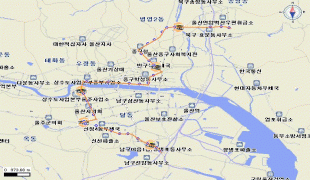
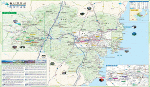
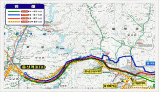
Map - Ulsan

Ulsan
Ulsan, officially the Ulsan Metropolitan City is South Korea's seventh-largest metropolitan city and the eighth-largest city overall, with a population of over 1.1 million inhabitants. It is located in the south-east of the country, neighboring Busan to the south and facing Gyeongju to the north.

Ulsan is the industrial powerhouse of South Korea, forming the heart of the Ulsan Industrial District. It has the world's largest automobile assembly plant, operated by the Hyundai Motor Company; the world's largest shipyard, operated by Hyundai Heavy Industries; and the world's third largest oil refinery, owned by SK Energy. In 2020, Ulsan had a GDP per capita of $65,352, the highest of any region in South Korea.

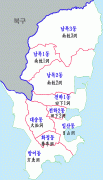
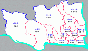
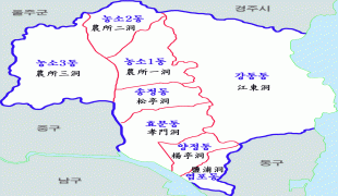
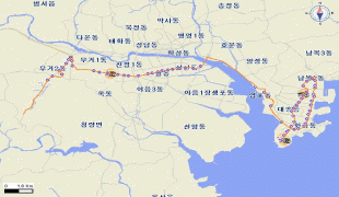
Ulsan is divided into four gu (districts) and one gun (county):

* Buk District

* Dong District

* Jung District

* Nam District

* Ulju County

 
Map - Ulsan
Map
Google - Map - Ulsan
Google
Google Earth - Map - Ulsan
Google Earth
Nokia - Map - Ulsan
Nokia
Openstreetmap - Map - Ulsan
Openstreetmap
onlinemainmap2.jpg
3645x2992
www.ulsanonline.com
onlinemainmap2.jpg
3645x2992
ulsanonline.com
telegraph-overall-ma...
2371x3479
www.dokdo-takeshima....
mapMugeodong.jpg
1240x1772
ulsanonline.com
ulsan_tour_map_02.jp...
1320x1556
2.bp.blogspot.com
ulsan_tour_map_04.jp...
1556x1317
2.bp.blogspot.com
Donggu-ulsan-map.png
1000x1750
upload.wikimedia.org
20120721113145!Jungg...
1500x981
upload.wikimedia.org
map_ulsan1_l.jpg
965x1277
sscorporation.com
map_ulsan1_l3.jpg
965x1277
www.sscorporation.co...
Bukgu-ulsan-map.png
1136x1000
upload.wikimedia.org
map.jpg
1004x1100
www.honeymoonfair.ne...
map_ulsan2_s.jpg
838x612
sscorporation.com
5004.jpg
716x544
ulsanonline.com
ulsanstart.jpg
720x540
gotothehash.net
106.jpg
714x511
www.ulsanonline.com
216.jpg
714x511
www.ulsanonline.com
1401.jpg
714x511
www.ulsanonline.com
ulsan_tour_map1.jpg
640x544
3.bp.blogspot.com
ktx_map.jpg
624x458
tour.ulsan.ac.kr
Country - South_Korea
Flag of South Korea
South Korea, officially the Republic of Korea, is a country in East Asia. It constitutes the southern part of the Korean Peninsula and borders North Korea along the Korean Demilitarized Zone. The country's western border is formed by the Yellow Sea, while its eastern border is defined by the Sea of Japan. South Korea claims to be the sole legitimate government of the entire peninsula and adjacent islands. It has a population of 51.96 million, of which roughly half live in the Seoul Capital Area, the fourth most populous metropolitan area in the world. Other major cities include Incheon, Busan, and Daegu.

The Korean Peninsula was inhabited as early as the Lower Paleolithic period. Its first kingdom was noted in Chinese records in the early 7th century BCE. Following the unification of the Three Kingdoms of Korea into Silla and Balhae in the late 7th century, Korea was ruled by the Goryeo dynasty (918–1392) and the Joseon dynasty (1392–1897). The succeeding Korean Empire (1897–1910) was annexed in 1910 into the Empire of Japan. Japanese rule ended following Japan's surrender in World War II, after which Korea was divided into two zones; a northern zone occupied by the Soviet Union and a southern zone occupied by the United States. After negotiations on reunification failed, the southern zone became the Republic of Korea in August 1948 while the northern zone became the communist Democratic People's Republic of Korea the following month.
Currency / Language  
ISO Currency Symbol Significant figures
KRW South Korean won â‚© 0
Neighbourhood - Country  
  •  North Korea 
Administrative Subdivision
Country, State, Region,...
City, Village,...