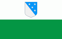
Valga County (Valgamaa)
 |
 |
Valga County is located in the southern part of Estonia. By the economic-geographical and regional-political distribution it belongs to the area of South-East Estonia (together with Põlva and Võru County). By historical ties and landscape the county belongs to the region of South Estonia (together with Põlva, Võru, Viljandi, Tartu and Jõgeva Counties). With a population of 30,176 people (as of 1 January 2014), the total area of the county is 2,043.53 km2 (2,046.49 km2 together with the area of Võrtsjärv), it reaches 65 km in the north–south direction and 59 km in the east–west direction. Valga County ranks the 12th in Estonia by population and the 14th by the area.
The distances from the county centre, Valga, are the following: Tallinn 267 km, Tartu 86 km, Viljandi 88 km, Võru 73 km, Põlva 96 km, Pärnu 141 km, Narva 264 km and Riga 157 km.
Valga County borders with Viljandi County in the north-west, with Tartu County in the north and Põlva and Võru County in the east. Valga County has a borderline with the Republic of Latvia in the south and west (102.4 km).
Map - Valga County (Valgamaa)
Map


Country - Estonia
 |
 |
| Flag of Estonia | |
The land of what is now modern Estonia has been inhabited by Homo sapiens since at least 9,000 BC. The medieval indigenous population of Estonia was one of the last pagan civilisations in Europe to adopt Christianity following the Papal-sanctioned Livonian Crusade in the 13th century. After centuries of successive rule by the Teutonic Order, Denmark, Sweden, and the Russian Empire, a distinct Estonian national identity began to emerge in the mid-19th century. This culminated in the 24 February 1918 Estonian Declaration of Independence from the then warring Russian and German Empires. Democratic throughout most of the interwar period, Estonia declared neutrality at the outbreak of World War II, but the country was repeatedly contested, invaded and occupied, first by the Soviet Union in 1940, then by Nazi Germany in 1941, and was ultimately reoccupied in 1944 by, and annexed into, the USSR as an administrative subunit (Estonian SSR). Throughout the 1944–1991 Soviet occupation, Estonia's de jure state continuity was preserved by diplomatic representatives and the government-in-exile. Following the bloodless Estonian "Singing Revolution" of 1988–1990, the nation's de facto independence from the Soviet Union was restored on 20 August 1991.
Currency / Language
| ISO | Currency | Symbol | Significant figures |
|---|---|---|---|
| EUR | Euro | € | 2 |
| ISO | Language |
|---|---|
| ET | Estonian language |
| RU | Russian language |


