Western Region (Western Region)
 |
The Western Region enjoys a long coastline that stretches from South Ghana's border with Ivory Coast to the Western region's boundary with the Central Region on the east.
The Western Region has the highest rainfall in Ghana, lush green hills, and fertile soils. There are numerous small and large-scale gold mines along with offshore oil platforms dominate the Western Region economy.
The culture is dominated by the Akans; the main languages are Akan, French and English.
The largest rivers are the Ankobra River, the Bia River, and the Pra River in the east, with the Tano River partly forming the western national border. The area is known for the UNESCO World Heritage Site and village of Nzulezo, built entirely on stilts and platforms over water, and the Ankasa Protected Area. There is a series of imposing Portuguese, Dutch, British, and Brandenburgian forts along the coast, built from 1512 on.
Map - Western Region (Western Region)
Map
Country - Ghana
 |
 |
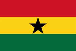
| Flag of Ghana | |
The Bono state existed in the area that is modern day Ghana during the 11th century. Kingdoms and empires such as Kingdom of Dagbon in the north and the Ashanti Empire in the south emerged over the centuries. Beginning in the 15th century, the Portuguese Empire, followed by other European powers, contested the area for trading rights, until the British ultimately established control of the coast by the 19th century. Following over a century of colonial resistance, the current borders of the country took shape, encompassing 4 separate British colonial territories: Gold Coast, Ashanti, the Northern Territories, and British Togoland. These were unified as an independent dominion within the Commonwealth of Nations. On 6th March 1957, Ghana became the first country in Sub-Saharan Africa to achieve sovereignty. Ghana subsequently became influential in decolonisation efforts and the Pan-African movement.
Currency / Language
| ISO | Currency | Symbol | Significant figures |
|---|---|---|---|
| GHS | Ghanaian cedi | ₵ | 2 |
| ISO | Language |
|---|---|
| AK | Akan language |
| EN | English language |
| EE | Ewe language |
| TW | Twi |


