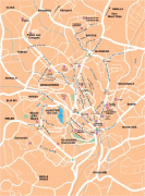
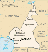
Yaoundé
Yaoundé is the capital of Cameroon and, with a population of more than 2.8 million, the second-largest city in the country after the port city Douala. It lies in the Centre Region of the nation at an elevation of about 750 metres (2,500 ft) above sea level.
The outpost of Epsumb or Jeundo was founded between the Nyong and Sanaga rivers at the northern edge of the area's forests in 1887 by German explorers as a trading base for rubber and ivory. A military garrison was built in 1895 which enabled further colonization. After Imperial Germany's defeat in World War I, France held eastern Cameroon as a mandate, and Yaoundé was chosen to become the capital of the colony in 1922.
Douala remained the more important settlement, but Yaoundé saw rapid growth and continued as the seat of government for the Republic of Cameroon upon its independence in 1960. Most of Yaoundé's economy is still centred on the administrative structure but major industries in Yaoundé include tobacco, dairy products, beer, clay, glass goods and timber. The city has many striking monuments and buildings, such as the Presidential Palace and Palais des Congrès.
The earliest inhabitants of Cameroon were likely the Bakas (pygmies). They still inhabit the forests of the south and east provinces. Bantu speakers originating in the Cameroonian highlands were among the first groups to move out before other invaders. During the late 1770s and early 1800s, the Fulani—a pastoral Islamic people of the western Sahel—conquered most of what is now northern Cameroon, subjugating or displacing its largely non-Muslim inhabitants.
The outpost of Epsumb or Jeundo was founded between the Nyong and Sanaga rivers at the northern edge of the area's forests in 1887, 1888, or February 1889 by the German explorers Lt. Richard Kund and Hans Tappenbeck by the agreement of the chiefs of Ela Esono. From December 1889 to May 1895, it was occupied by the German botanist Georg August Zenker as an agricultural research station named Jaunde after the local Yaunde or Ewondo people. His settlement served as a base for the area's rubber and ivory trade, purchasing these from the natives in exchange for imported clothing and iron. It was also known in English as Yaunde Station. Major Dominik's establishment of a military garrison at the site in 1895 permitted a Pallotine mission and religious school at nearby Mvolyé (now a suburb).
During World War I, Jaunde was occupied by Belgian troops from the Congo. After Imperial Germany's defeat in that war, France held eastern Cameroon as a mandate of the League of Nations and Yaoundé was chosen to become the capital of the colony in 1922. Douala long remained the more important settlement, but Yaoundé saw rapid growth after 1957 due to the cocoa crisis and unrest along the coast. It continued as the seat of government for the Republic of Cameroon upon its independence.
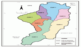
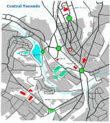
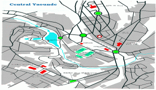
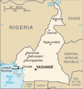
Map - Yaoundé
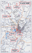
Map


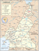
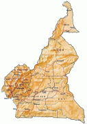


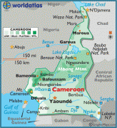
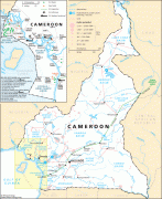
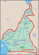
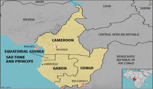
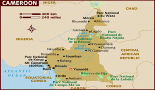
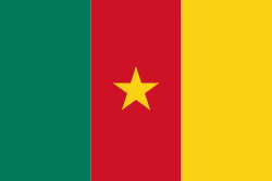
Country - Cameroon
 |
 |
| Flag of Cameroon | |
Early inhabitants of the territory included the Sao civilisation around Lake Chad, and the Baka hunter-gatherers in the southeastern rainforest. Portuguese explorers reached the coast in the 15th century and named the area Rio dos Camarões (Shrimp River), which became Cameroon in English. Fulani soldiers founded the Adamawa Emirate in the north in the 19th century, and various ethnic groups of the west and northwest established powerful chiefdoms and fondoms. Cameroon became a German colony in 1884 known as Kamerun. After World War I, it was divided between France and the United Kingdom as League of Nations mandates. The Union des Populations du Cameroun (UPC) political party advocated independence, but was outlawed by France in the 1950s, leading to the national liberation insurgency fought between French and UPC militant forces until early 1971. In 1960, the French-administered part of Cameroon became independent, as the Republic of Cameroun, under President Ahmadou Ahidjo. The southern part of British Cameroons federated with it in 1961 to form the Federal Republic of Cameroon. The federation was abandoned in 1972. The country was renamed the United Republic of Cameroon in 1972 and back to the Republic of Cameroon in 1984 by a presidential decree by president Paul Biya. Paul Biya, the incumbent president, has led the country since 1982 following Ahidjo's resignation; he previously held office as prime minister from 1975 on. Cameroon is governed as a Unitary Presidential Republic.
Currency / Language
| ISO | Currency | Symbol | Significant figures |
|---|---|---|---|
| XAF | Central African CFA franc | Fr | 0 |
| ISO | Language |
|---|---|
| EN | English language |
| FR | French language |