Zhob
Zhob (ژوب) or Zhobak (ژوبک), formerly known as Appozai or Fort Sandeman, is a city and district capital of Zhob District in Balochistan province of Pakistan. Zhob is located on the banks of Zhob River 337 km from Quetta, the capital of Balochistan.
The city was originally named Appozai after a nearby village. During the British colonial era, it was named Fort Sandeman after the British Indian Army officer, Robert Groves Sandeman. It obtained its current name on 30 July 1976 when the then-Prime Minister of Pakistan, Zulfikar Ali Bhutto had the name changed.
And Another One is Toor Samanzai, The Village of Great Haji Jalal Gul, He Is known for his bravery, Here we can see the Zaitoon Forests, Visiting place Oboo Shakh, Tarjana Narai, Shaly Narai, Uzgii Ghbarga, Sur Ghundai, And Other Mountain of Grass.
* 1) silyaza One of the most visited Picnic spot of Zhob District, Pakistan. The stream surrounded by the orchards of Apples, Grapes, Almond and Apricots and large No of fields of Maze and wheat. Pashtoon tribe living here are Mandokhail and village named Takai.
* 2) Paryan-o-Ghundi
Map - Zhob
Map
Country - Pakistan
 |
 |
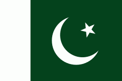
| Flag of Pakistan | |
Pakistan is the site of several ancient cultures, including the 8,500-year-old Neolithic site of Mehrgarh in Balochistan, the Indus Valley civilisation of the Bronze Age, the most extensive of the civilisations of the Afro-Eurasia, and the ancient Gandhara civilization. The region that comprises the modern state of Pakistan was the realm of multiple empires and dynasties, including the Achaemenid; briefly that of Alexander the Great; the Seleucid, the Maurya, the Kushan, the Gupta; the Umayyad Caliphate in its southern regions, the Hindu Shahis, the Ghaznavids, the Delhi Sultanate, the Mughals, the Durranis, the Omani Empire, the Sikh Empire, British East India Company rule, and most recently, the British Indian Empire from 1858 to 1947.
Currency / Language
| ISO | Currency | Symbol | Significant figures |
|---|---|---|---|
| PKR | Pakistani rupee | ₨ | 2 |
| ISO | Language |
|---|---|
| EN | English language |
| PA | Panjabi language |
| PS | Pashto language |
| SD | Sindhi language |
| UR | Urdu |


