Zvartnots International Airport (Zvartnots International Airport)
Zvartnots International Airport (Զվարթնոց միջազգային օդանավակայան) is located near Zvartnots, 15 km west of Yerevan, the capital city of Armenia. It acts as the main international airport of Armenia and is Yerevan's main international transport hub. It is the busiest airport in the country.
The airport was opened in 1961, and following a design competition held in 1970, M. Khachikyan, A. Tarkhanyan, S. Qalashyan, L. Cherkezyan and M. Baghdasaryan won the right to design the first terminal building. The airport was renovated in the 1980s with the development of a new terminal area, in order to meet domestic traffic demands within the Soviet Union.
When Armenia declared its independence from the Soviet Union in the 1990s, the growth of cargo shipments resulted in the construction of a new cargo terminal in 1998 that can handle about 100,000 tonnes of cargo annually. In 2001, a 30-year concession agreement for the management of operations at the airport was signed with Armenia International Airports CJSC, owned by Argentine company Corporación America, which is in turn owned by Armenian Argentine businessman Eduardo Eurnekian. As part of that agreement, Armenia International Airports CJSC renovated the runway, main taxiways and ramp. In 2006, a new gate area and arrivals hall opened, followed by an overall improvement of the airport's fire services, including replacing the entire fire-fighting fleet with new vehicles. A new departures and arrivals terminal, car-parking facility with a capacity of 600 vehicles and a government delegation terminal all opened in 2011. On 30 January 2013, Zvartnots airport was named "Best Airport In the CIS" during the Emerging Markets Airports Award (EMAA) ceremonies held in Dubai, United Arab Emirates.
| IATA Code | EVN | ICAO Code | UDYZ | FAA Code | |
|---|---|---|---|---|---|
| Telephone | Fax | ||||
| Home page | Hyperlink |
Map - Zvartnots International Airport (Zvartnots International Airport)
Map
Country - Armenia
 |
 |
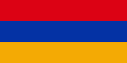
| Flag of Armenia | |
Armenia is a unitary, multi-party, democratic nation-state with an ancient cultural heritage. The first Armenian state of Urartu was established in 860 BC, and by the 6th century BC it was replaced by the Satrapy of Armenia. The Kingdom of Armenia reached its height under Tigranes the Great in the 1st century BC and in the year 301 became the first state in the world to adopt Christianity as its official religion. The ancient Armenian kingdom was split between the Byzantine and Sasanian Empires around the early 5th century. Under the Bagratuni dynasty, the Bagratid Kingdom of Armenia was restored in the 9th century. Declining due to the wars against the Byzantines, the kingdom fell in 1045 and Armenia was soon after invaded by the Seljuk Turks. An Armenian principality and later a kingdom Cilician Armenia was located on the coast of the Mediterranean Sea between the 11th and 14th centuries.
Currency / Language
| ISO | Currency | Symbol | Significant figures |
|---|---|---|---|
| AMD | Armenian dram | Ö | 2 |
| ISO | Language |
|---|---|
| HY | Armenian language |


